
Walking: Southall to Uxbridge
There were strikes on this weekend, so instead of taking a train out of London for a walk, I decided to do a few urban Slow Ways routes, from Southall via Hounslow, Harlington, and Iver, to Uxbridge.
Southall has a brand new station, built for the Elizabeth Line, to replace the slightly dingy one just to the south. From here, I walked a short stretch along a few residential roads, although there was a nice cycle path along the road to the Grand Union Canal.

Instead of going through Wolf Fields Park, the route took me around it with fences on both side. I don't know what. After a few more residential roads, I crossed under the M4 although the route's surroundings stayed the same. After crossing the A4 the route briefly goes through Lampton Park, where my planned route was blocked due to a new development. The detour through the park was probably more pleasant though. As it seems like a temporary blockage, I don't think the route needs adjusting.

From Hounslow Central I returned back towards Lampton Park, where a fun fair was just breaking up. This caused a few annoyances are trucks and cars where on the footpath in the park. Although the route tries to avoid main roads as much as possible, the slog along the A4 towards Heathrow was particularly unpleasant.
After crossing the River Crane, the walk finally moved away from a busy road, first along Cranford Park for a little, and then along a lane (with pavement) towards Harlington.

After Harlington, the route continued much as before, by going along a lane. It was not busy with traffic, and there was a fair amount of open space so it wasn't that bad in the end. After going through the little village of Harmondsworth, the walk became actually pleasant, even though it started through a graveyard.

It was a little muddy going around Saxon Lake, but it was quiet and green with a white dusting of fallen blossom. The crossing underneath the M4 had some graffiti on it. Mostly the annoying kind.

The route continued following the River Colne, through some nice green woods. There was then a short (but safe) section without pavement, and a very narrow footpath towards Thorney. Here the route went alongside a golf course, and it some points crossed it. Crossing underneath the Great Western Main Line was haphazard, as the tunnel was not quite high enough for me!
The route then followed the Colne Valley trail/footpath for a bit all the way towards the Grand Union Canal's Slough Arm. I always liked walking alongside it and this weekend was no exception.

After leaving the canal, the walk into Iver is again along a main road, as bridge across the canal had collapsed a few years ago.

Beyond Iver, my walk followed a section of the Beeches Way which I walked at the end of 2021.
After a lovely walk here, I crossed the M25 into London again. After a short stretch along Iver Lane, my walk joined the London LOOP along the lovely River Colne, with a fair amount of butterflies, to finally end up at some residential streets in Uxbridge, which brought me to the station, and then home (and the pub!).


Life Line
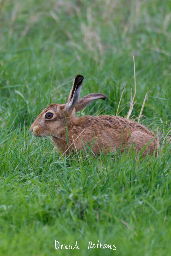
Brown Hare
Altough we were looking for birds, we couldn't not observe this lovely hare munching away in the grass. It had clearly seen us, but didn't seem to be bothered.
#photography #NaturePhotography #wildlife #Norfolk
Confirmed a restaurant
Updated 2 restaurants and a cosmetics shop; Confirmed a restaurant
Updated a restaurant
I walked 7.4km in 1h15m40s
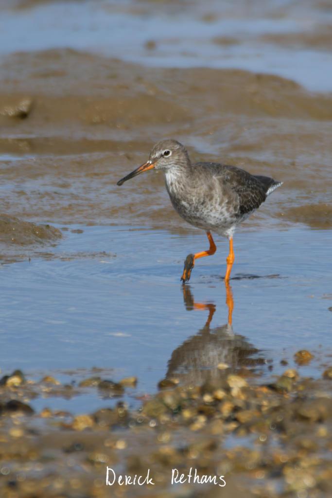
Redshank Strolling On The Mud
This lovely bird was mooching about white close by on the mudflat at Brancaster Staithe. Picking through the puddles and mud to find something to eat.
#photography #Birds #BirdPhotography #BirdsOfFediverse #NaturePhotography #wildlife #Norfolk
Specify whether public transport stops have bins
Determine whether amenities are inside buildings
Specify whether public transport stops have tactile paving
Determine place names
Survey if vacant places are still vacant
Survey if places still exist
Determine roads lane count
Specify whether there are crossings at intersections of paths and roads
Survey tactile paving on steps
Specify whether steps have a ramp
Specify which way leads up for steps
Specify whether steps have handrails
Survey if places still exist
Specify cycle barrier installation
Specify cycle barrier types
Specify whether roads have lane markings
Specify whether there are cycleways
Specify bollard types
Specify width of opening
Shortlink
This article has a short URL available: https://drck.me/sou-uxb-hwi