
Maps (the non-digital variety)
As you probably know, I am pretty much into OpenStreetMap and digital maps. I have always found (paper) maps, and different visualisations fascinating. I found myself at London GeoMob last Thursday where I encountered two types of non-digital, non-paper maps.
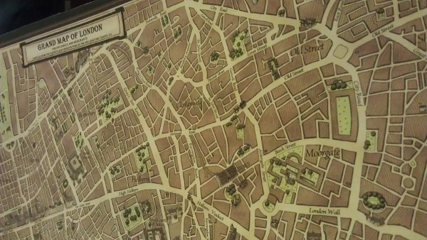
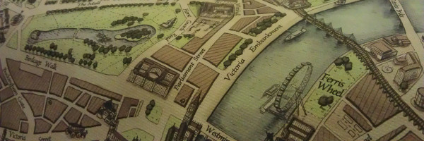
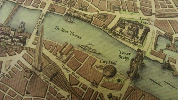
The first one, was a 1800s style rendering of London from Wellingtons Travel — fully hand-drawn. I found them quite beautiful, and would be happy to have one on my wall. Some pictures that I took of it are here:
I am even more excited about a second project: SplashMaps. At some point you probably have been in a situation where you were out and about walking somewhere in a city or the country and you had to find your way. In cities you can often ask people and/or get our your phone, but that doesn't cut it when you are on some remote hill in Scotland. You need a paper map (for more than one reason!). And of course, it is always raining (we're in Scotland after all!). Ordnance Survey will sell you laminated Explorer Maps for this, which have saved me quite a few times. However, they are bulky and the place that you are looking for is either always on a fold, or on the opposite site of the map!
At GeoMob a solution showed up in the form of SplashMaps—they are basically a map printed on cloth, water-proof, but you can still use a marker to mark out your route, wash it, and it is good as new again. Here is a picture of one of their prototypes of the New Forest:
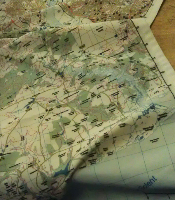
The maps are specifically made with walking and cycling (in national parks) in mind, so it has all the features that are important: paths, bike repair shops, bogs and pubs (and a lot more!). They are currently running a funding round on KickStarter and I would urge you to check them out. I have backed the project and looking forwards to getting my maps for my favourite parks... I do need to think about which ones they are!


Life Line
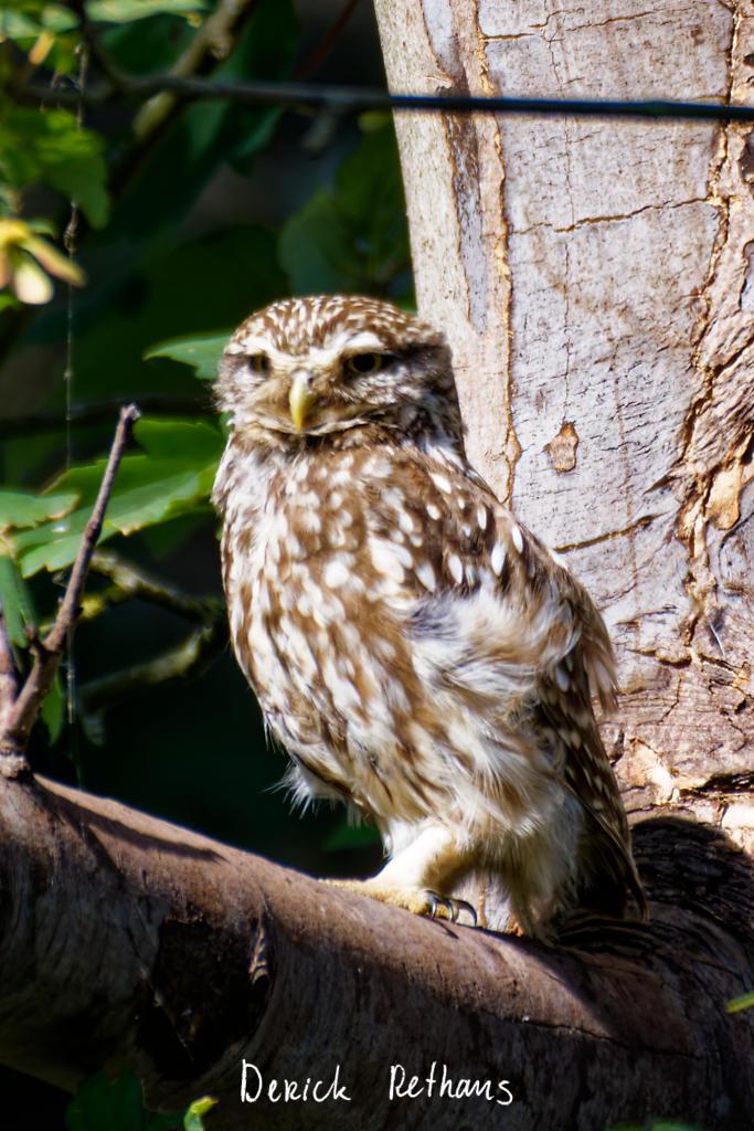
Little Owl owlet
This lovely owlet was quite easy to find in a London Park, with some help as they camouflage so well!
I saw its sibling too.
#BirdPhotography #BirdsOfFediverse #Photography #Nature #London #BirdsOfMastodon
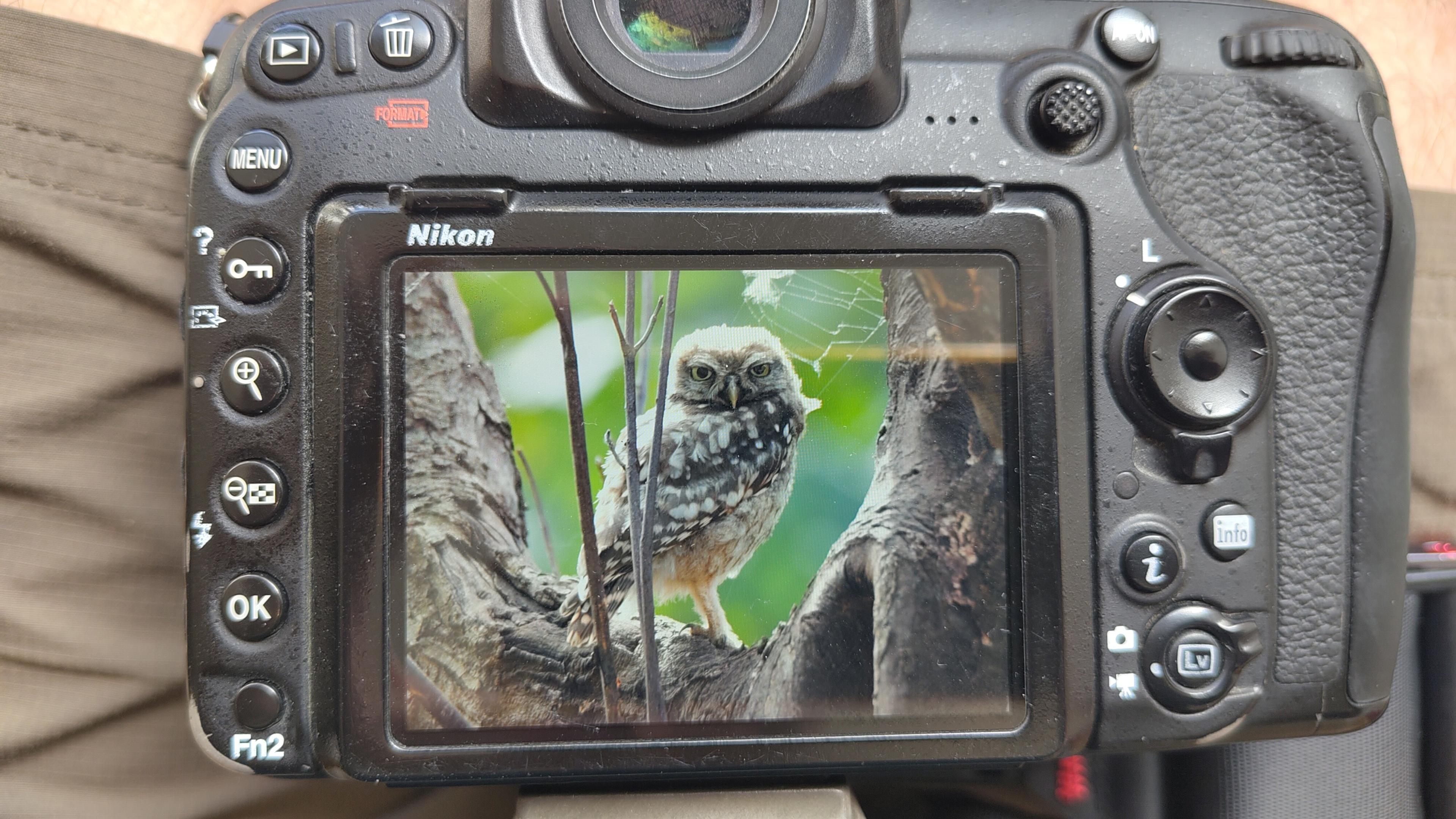
I went to a park (Bushy Park) to look for some owls.
I found Owls (Little and Tawny), but also a Green Woodpecker and two Kingfishers.
Snaps from my camera screen, and real photos will follow, but not of the Kingfishers as they were too far away and the photos are blurry.
#london #BirdPhotogaphy #BirdsOfMastodon #Birds #photography #BirdsOfFediverse #BushyPark
I hiked 13.8km in 4h44m12s
Created a chocolate shop and a restaurant; Updated 6 restaurants and an address; Confirmed 5 restaurants, a community_centre, and 3 other objects
Created a restaurant, a fast_food, and 2 other objects; Deleted a restaurant
I walked 8.5km in 1h31m45s
Created 2 buildings and a hairdresser shop; Updated a restaurant and an estate_agent office; Confirmed a cafe
I walked 2.2km in 38m09s
Merged pull request #1096
Bump actions/checkout from 6 to 7
Merged pull request #1095
Improve Tiverton Green mapping
Created 2 gates
I walked 7.1km in 1h23m15s
I walked 1.0km in 9m24s
Realign streets. They now have much less wide corners into each other.
Updated a fast_food
I walked 9.1km in 1h35m41s
I hiked 4.7km in 3h24m10s
I walked 6.7km in 1h12m03s
I walked 7.7km in 1h47m24s
Updated a pub
Updated a pub
Created a bar; Updated a bar; Confirmed a restaurant and a bar
Shortlink
This article has a short URL available: https://drck.me/maps-9ms