
Flat vs. Sphere
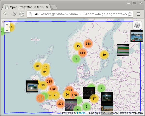
For the preparation of my Finding Pubs... (and other things) presentation that I gave at the PHP NorthWest usergroup some time ago I created a demo that shows all my flickr photos on a map. For example like:
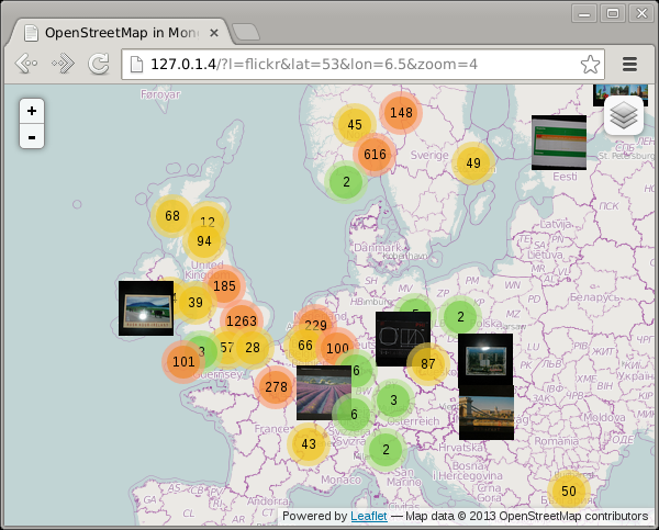
This example shows photos in the UK, Norway and Sweden as well as in Paris.
In order to not find too many photos that are not going to be in the portion of the world that the display covers, I add a bounding box to my find() query:
$polygon = GeoJSONPolygon::createFromBounds(
        min( 90, (float) $_GET['n'] ),
        min( 180, (float) $_GET['e']) ,
        max( -90, (float) $_GET['s'] ),
        max( -180, (float) $_GET['w'] )
);

$c = $d->selectCollection( 'flickr' );
$query = array(
        LOC => array(
                '$geoWithin' => array(
                        '$geometry' => $polygon->getGeoJSON(),
                ),
        ),
);
$s = $c->find( $query )->limit( 8000 );
The North, East, South and West points are being passed as argument to the fetch-poi.php script like: http://127.0.1.4/maps-flickr/fetch-poi.php?n=65.44000165965534&e=32.51953125&s=46.07323062540838&w=-19.51171875
Now if we scroll up a bit to include Iceland in the map, then we see that the photos in Paris disappear:
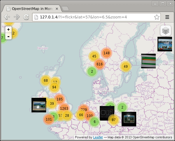
How is that possible? Let's first see what our polygon looks like:
<?php
include 'classes.php';

$_GET = array(
        'n' => 65.44000165965534,
        'e' => 32.51953125,
        's' => 46.07323062540838,
        'w' => -19.51171875,
);

$polygon = GeoJSONPolygon::createFromBounds(
        min( 90, (float) $_GET['n'] ),
        min( 180, (float) $_GET['e']) ,
        max( -90, (float) $_GET['s'] ),
        max( -180, (float) $_GET['w'] )
);

var_dump($polygon);
?>
Which outputs:
class GeoJSONPolygon#1 (1) {
  public $pg =>
  array(1) {
        [0] =>
        array(5) {
          [0] =>
          array(2) {
                [0] => double(32.51953125) [1] => double(65.440001659655)
          }
          [1] =>
          array(2) {
                [0] => double(-19.51171875) [1] => double(65.440001659655)
          }
          [2] =>
          array(2) {
                [0] => double(-19.51171875) [1] => double(46.073230625408)
          }
          [3] =>
          array(2) {
                [0] => double(32.51953125) [1] => double(46.073230625408)
          }
          [4] =>
          array(2) {
                [0] => double(32.51953125) [1] => double(65.440001659655)
          }
        }
  }
}
The 5 array elements in here reflect in order the North East point, the North West point, the South West point, the South East point and again the North East point. If we draw lines between those points on the map, we find:
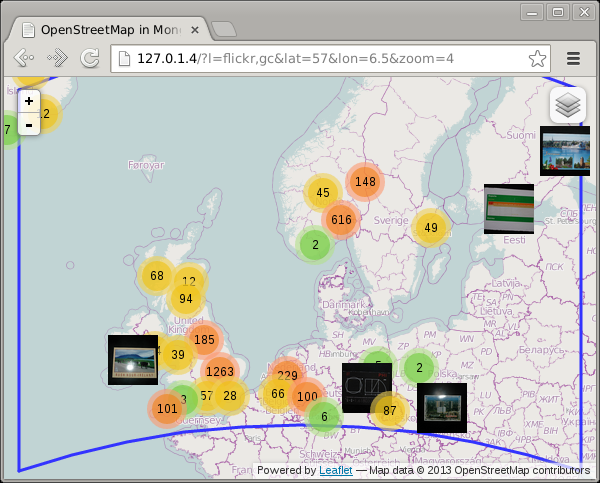
Which instantly shows you why I got missing photos! As you can see, the shortest line between vertical lines is a straight line on a sphere, but the horizontal lines are not straight. The shortest path on a sphere, as expressed with a Spherical Mercator projection is often a curve, called the Great Circle path. Because MongoDB's 2dsphere index is a true spherical index (as opposed to the 2d index which cheats), the polygon it uses to find the photos is not a square as you can see in the image above. This illustrates the main difference between spherical geospatial queries, and ones that only deal with a flat rectangular map.
Leaflet, the mapping library that I use, does not actually draw lines as Great Circle paths, so I had to calculate them myself. The maps-great-circle code on GitHub shows how I did that. Basically I created points along the Northern and Southern border on the exact latitude.
If you create one intermediate point, the result is:
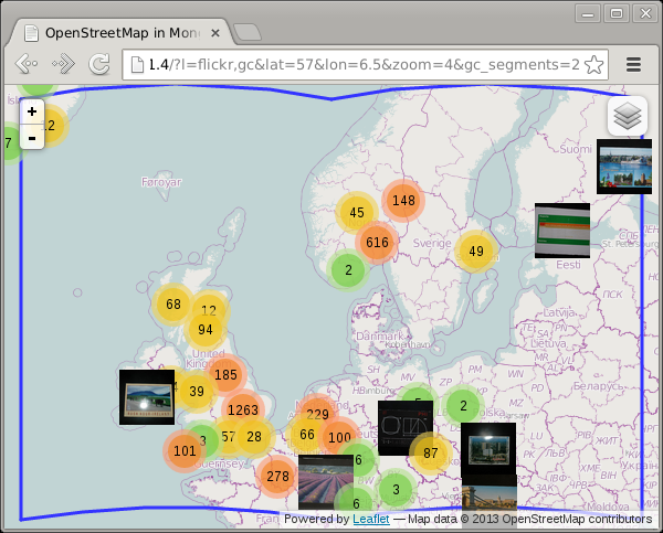
And with five intermediate points you hardly notice the problem anymore:
Play around with the gc_segments URL parameter to see for yourself:
-
http://maps.derickrethans.nl/?l=flickr,gc&zoom=5&gc_segments=1
-
http://maps.derickrethans.nl/?l=flickr,gc&zoom=5&gc_segments=2
-
http://maps.derickrethans.nl/?l=flickr,gc&zoom=5&gc_segments=3
-
http://maps.derickrethans.nl/?l=flickr,gc&zoom=5&gc_segments=10
Next up in the series is "Showing all the World's Timezones" which will explain how I created the tiles that highlight the timezones at http://maps.derickrethans.nl/?l=timezones&lon=50&lat=30&zoom=3


Life Line
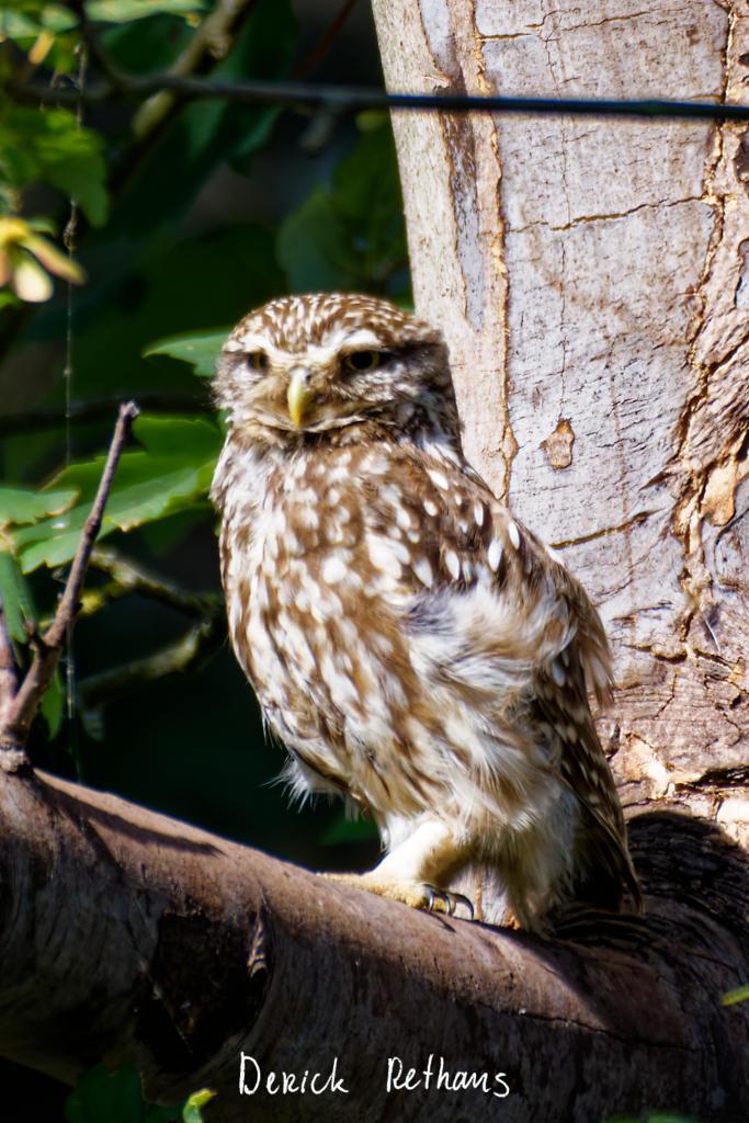
Little Owl owlet
This lovely owlet was quite easy to find in a London Park, with some help as they camouflage so well!
I saw its sibling too.
#BirdPhotography #BirdsOfFediverse #Photography #Nature #London #BirdsOfMastodon
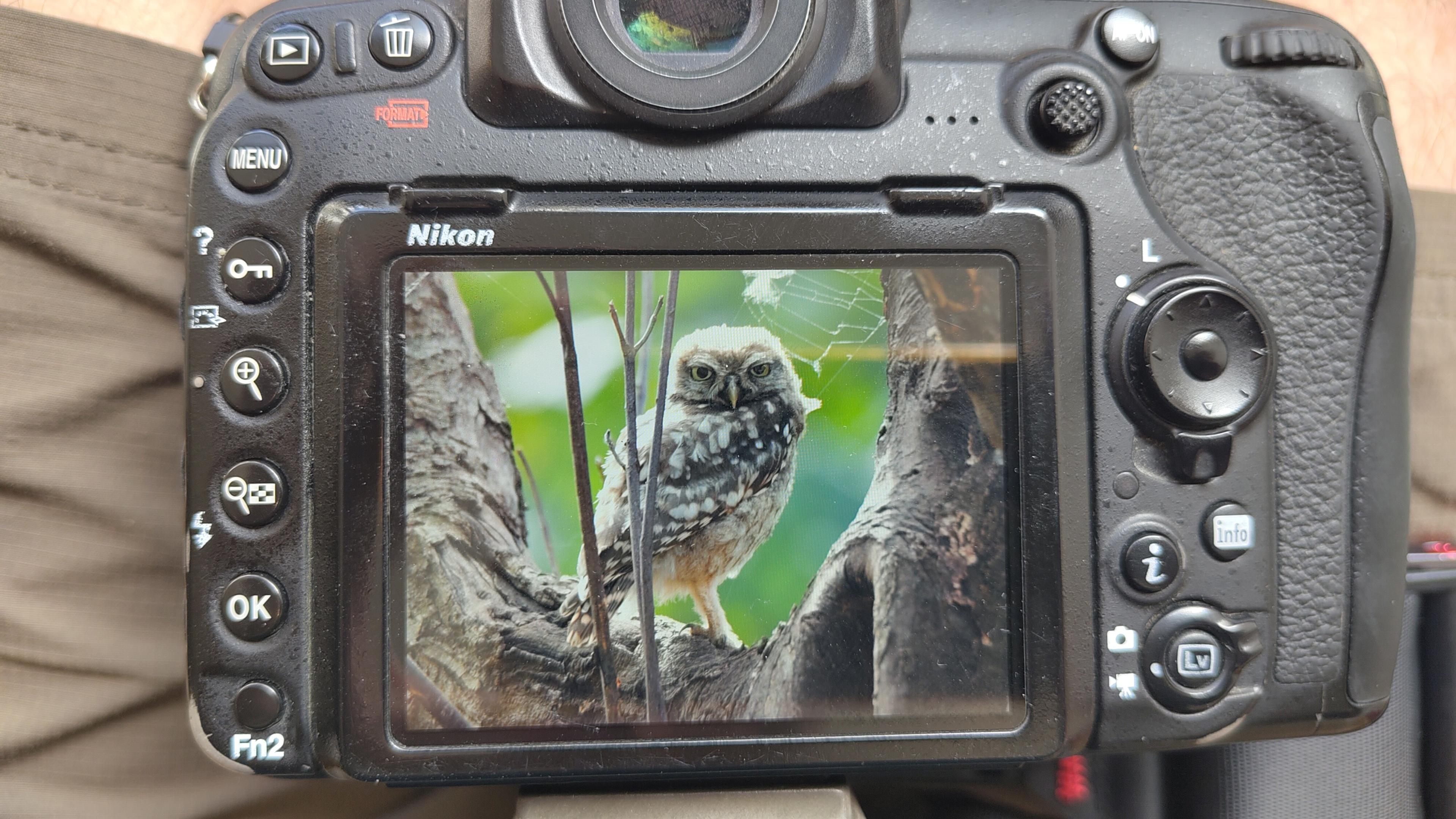
I went to a park (Bushy Park) to look for some owls.
I found Owls (Little and Tawny), but also a Green Woodpecker and two Kingfishers.
Snaps from my camera screen, and real photos will follow, but not of the Kingfishers as they were too far away and the photos are blurry.
#london #BirdPhotogaphy #BirdsOfMastodon #Birds #photography #BirdsOfFediverse #BushyPark
I hiked 13.8km in 4h44m12s
Created a chocolate shop and a restaurant; Updated 6 restaurants and an address; Confirmed 5 restaurants, a community_centre, and 3 other objects
Created a restaurant, a fast_food, and 2 other objects; Deleted a restaurant
I walked 8.5km in 1h31m45s
Created 2 buildings and a hairdresser shop; Updated a restaurant and an estate_agent office; Confirmed a cafe
I walked 2.2km in 38m09s
Merged pull request #1096
Bump actions/checkout from 6 to 7
Merged pull request #1095
Improve Tiverton Green mapping
Created 2 gates
I walked 7.1km in 1h23m15s
I walked 1.0km in 9m24s
Realign streets. They now have much less wide corners into each other.
Updated a fast_food
I walked 9.1km in 1h35m41s
I hiked 4.7km in 3h24m10s
I walked 6.7km in 1h12m03s
I walked 7.7km in 1h47m24s
Updated a pub
Updated a pub
Created a bar; Updated a bar; Confirmed a restaurant and a bar
Shortlink
This article has a short URL available: https://drck.me/gc-a98