
Walking the Capital Ring - Section 10
I'm way behind typing these up. About two months!
Section 10
What should have been a quick tube ride up to South Kenton, ended up taking nearly 2 hours. You guess it, Sunday Rail Engineering Works. On top of that, we got a replacement bus, with a driver that had no idea where to go. Initially he went the wrong direction along the line. As it was a bit unclear whether it would actually stop at South Kenton, we got off one stop earlier at North Wembley, and walked to the start instead.
Once we started with the walk, we quickly realized that it was unlikely that we were going to walk two stages (10 and 11). The first 10 minutes made it very clear it was going to be warm, and very sweaty.

We quickly came through Preston Park, and upon Preston "High" Road, which we crossed to walk through a few residential streets to start up our climb up the hill through the Barn Hill Open Space. We had a quick water break at the stop—it was really warm and humid—for some relaxing. The Ring then goes around the little lake on the top of the hill, where you can find a trigpoint and a lovely view of Wembley Stadium.

After crossing a road, we had another small climb in Fryent Country Park. It was a bit tricky to follow the route there with vague signing, and the presence of lots of little rows of trees, making navigating quite tricky. As this section of the Capital Ring was mapped well on OpenStreetMap, we find our way out, and assisted a local to find her way out of the maze as well.
We continued among more residential streets and ended up circling St. Andrew's Kingsbury church. After having a look at its cemetery we walked around the Welsh Harp Sailing Association. The name comes from nearby Welsh Harp, which is a large water reservoir to supply London homes with drinking water. A large part of the rest of Section 10 goes past this reservoir. We stopped again for a little water break.

After crossing the narrow bridge over the Silk Stream we shortly came upon West Hendon Broadway. Section 10 goes all the way to Hendon Park, but we chickened out early here. I ended up extensively mapping many of the shops along the Broadway. From here on, it was a straight bus down to Kilburn.
|
Route (with GPX) |
|
|
Time |
1h 52m 37s |
|
Distance |
8.73 km |
|
Average Heart Rate |
103 bpm |
|
Calories Burned |
970 cal |
For the full photo series, see my Flickr set.


Life Line
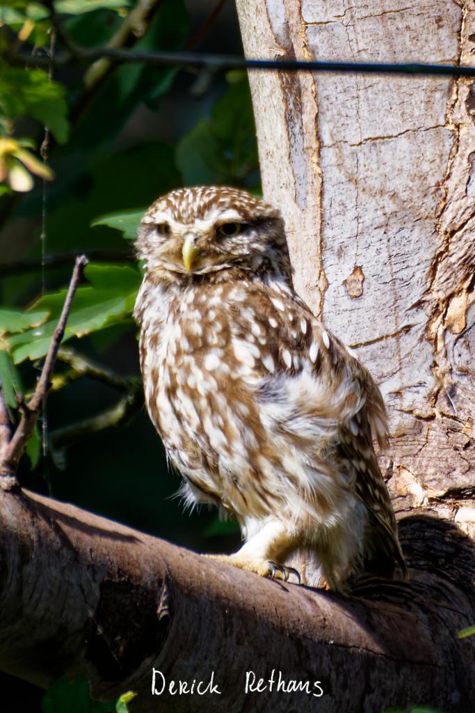
Little Owl owlet
This lovely owlet was quite easy to find in a London Park, with some help as they camouflage so well!
I saw its sibling too.
#BirdPhotography #BirdsOfFediverse #Photography #Nature #London #BirdsOfMastodon
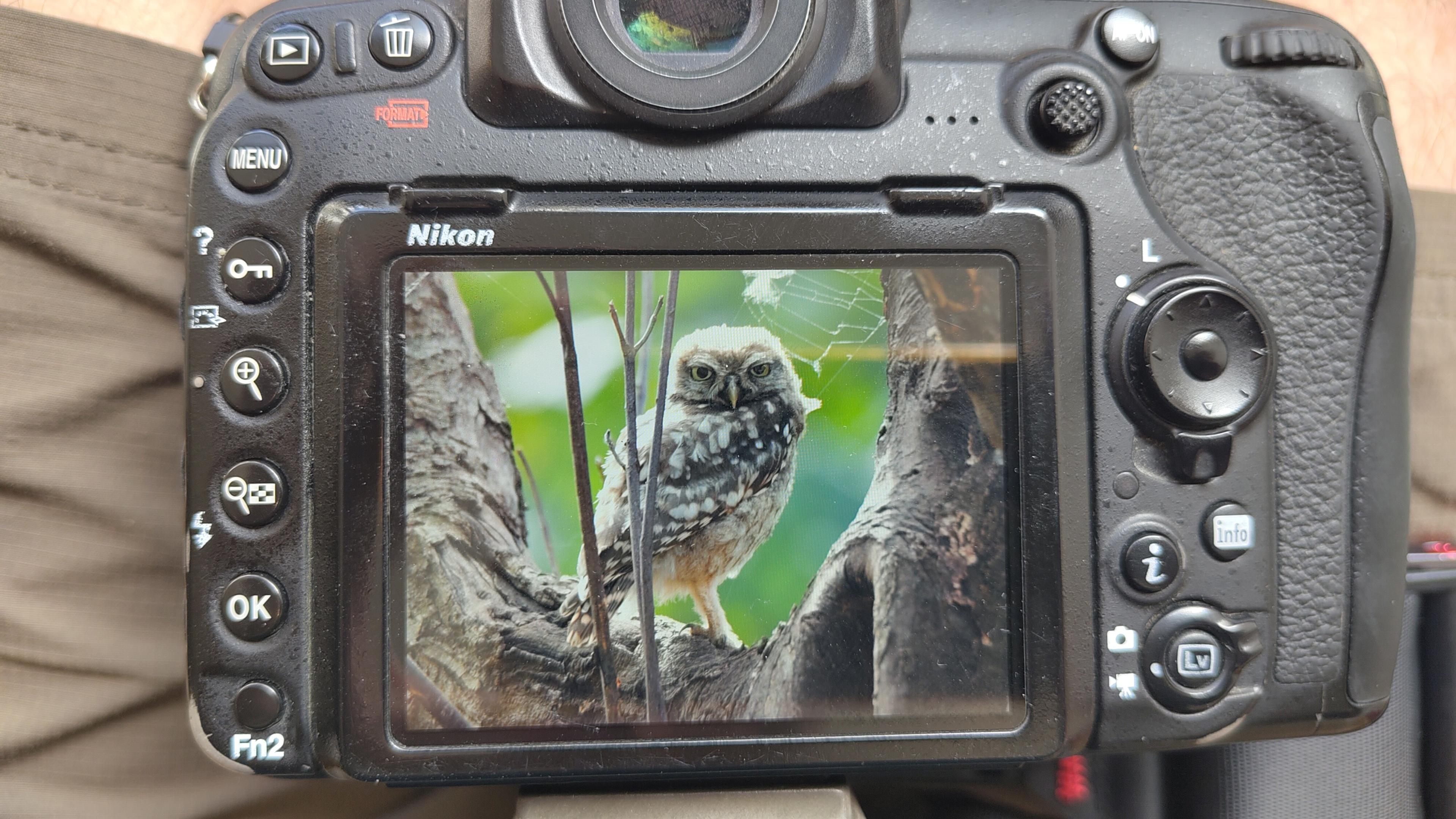
I went to a park (Bushy Park) to look for some owls.
I found Owls (Little and Tawny), but also a Green Woodpecker and two Kingfishers.
Snaps from my camera screen, and real photos will follow, but not of the Kingfishers as they were too far away and the photos are blurry.
#london #BirdPhotogaphy #BirdsOfMastodon #Birds #photography #BirdsOfFediverse #BushyPark
I hiked 13.8km in 4h44m12s
Created a chocolate shop and a restaurant; Updated 6 restaurants and an address; Confirmed 5 restaurants, a community_centre, and 3 other objects
Created a restaurant, a fast_food, and 2 other objects; Deleted a restaurant
I walked 8.5km in 1h31m45s
Created 2 buildings and a hairdresser shop; Updated a restaurant and an estate_agent office; Confirmed a cafe
I walked 2.2km in 38m09s
Merged pull request #1096
Bump actions/checkout from 6 to 7
Merged pull request #1095
Improve Tiverton Green mapping
Created 2 gates
I walked 7.1km in 1h23m15s
I walked 1.0km in 9m24s
Realign streets. They now have much less wide corners into each other.
Updated a fast_food
I walked 9.1km in 1h35m41s
I hiked 4.7km in 3h24m10s
I walked 6.7km in 1h12m03s
I walked 7.7km in 1h47m24s
Updated a pub
Updated a pub
Created a bar; Updated a bar; Confirmed a restaurant and a bar
Shortlink
This article has a short URL available: https://drck.me/cr10-cm8