
Walking: Bushey to Wembley
On my second SlowWays walk of the year I walked from Bushey to Wembley.

I started at Bushey station, which isn't quite the start of the actual route. From there, I made a bee-line towards the Attenborough Fields. Going directly up them was a bit of a chore, as the fields could more accurately described as a "flood plain". The actual path was a fast flowing stream, so I wandered along the other side of the hedge up the hill. Here cows blocked my path and I had to divert and jump a fence (sorry) to rejoin the route just before it crosses Merry Hill Lane. From there the paths where mostly different grades of mud, with some standing water. I followed a straight line along Merry Hill circular footpath, where my planned route directed me to cross a stream before turning west. I couldn't get through the scrubs and woods, and across the stream here, so I had to backtrack to one path north, and then go west again.
The route that I was following shows to cross the stream on the north-west corner of the golf course. OpenStreetMap shows a ford here. Due to the rain, the stream had turned into a fast flowing, 8 inches deep, river. I checked around for 15 minutes if there was another route across (there wasn't), or if I could find big enough sticks to build a makeshift bridge (there weren't), but ultimately decided to walk through the stream to the other side. I should have worn my hiking boots instead of hiking shoes, as they were certainly not up to the task. Squelch squelch for a few miles!
I then continued along the path through the woods between the sections of the golf course, and across another mini ravine, to end up on the golf course, where this route joins the London LOOP. I followed the well sign posted route all the way to a view point, after deciding I didn't want to walk along the road with traffic. The route as mapped here isn't that accurate, and following the LOOP is probably recommended. There was some construction near Gilberts Lake due to some invasive species.

After the view point I went down a minimally muddy path and ended up at Uxbridge Road, which was a little tricky to cross due to a lot of traffic, and had no official crossing point. From this point, I walked for a while along residential streets with an occasional dedicated footpath, and then a long stretch along Harrow View with loads of new flats and other housing, before weaving through buses to end up at Harrow-on-the-Hill station where my first section ended.
From Harrow-on-the-Hill station, my route followed College Road and then Station Road to end up on the bottom of a hill covered with grass. I should have paid a little more attention and gone through the station, and leave it through its southern exit. This would have avoided a slog along some shops. That exit also handily has free public toilets, which I have used on previous occasions, when walking the Tube.
The path up the hill is steep, but it has pleasant views at the top — even on a dreary day as this one was. After following a little muddy path, the route goes straight up the hill to the church, with more great views, and then back down steps to end up at the north end of Church Fields, which I crossed to join the narrow and twisty streets of Harrow. I nearly slid on my bum though due to the mud. If you don't care about the view and don't want to go up all the way to the church, you can walk through the bottom rung of the graveyard instead. Spookier though.

After leaving Harrow-on-the-Hill, I proceeded along the busy Northolt Road for a bit, and turned away from it just before South Harrow station. I then walked along a recreation field, but made sure to not go into the park, as I wouldn't have been able to leave it at the other side. Instead I followed the less glamorous public footpath on the other side of the fence.

I then crossed the railway and across the Harrow sidings, to continue along the fairly busy Mandeville Road to end up, and finish the second section Northolt tube station.
The third and final section was pretty dull, and without much green. From Northolt I walked through a residential crescent, and then I turned right at the church on the hill. More residential streets and busy roads followed, with parades of shops. The little bit of green on this section of the walk was when I went up Horsenden Hill, where my route follows the Capital Ring for a short bit. After another parade of shops on Whitten Avenue West, I walked up onto a bridge to cross the tube tracks, where there was quite a fair view.

After coming down, I spotted the nice looking Sudbury Town tube station, and continued along boring and car heavy Harrow Road. Barham park is on the other side of the road, which would have been nicer I suppose. I finished my walk at Wembley Central tube station.
Hopefully for the next walk the weather is better, so I can pick a nicer walk with less street walking and more green.


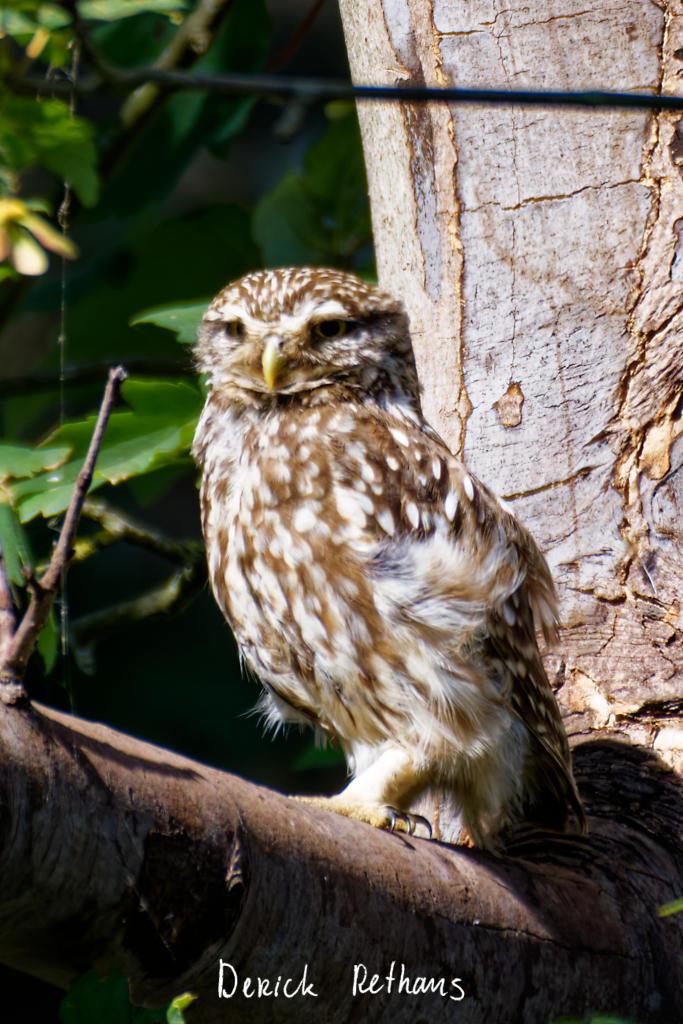
Life Line
Little Owl owlet
This lovely owlet was quite easy to find in a London Park, with some help as they camouflage so well!
I saw its sibling too.
#BirdPhotography #BirdsOfFediverse #Photography #Nature #London #BirdsOfMastodon
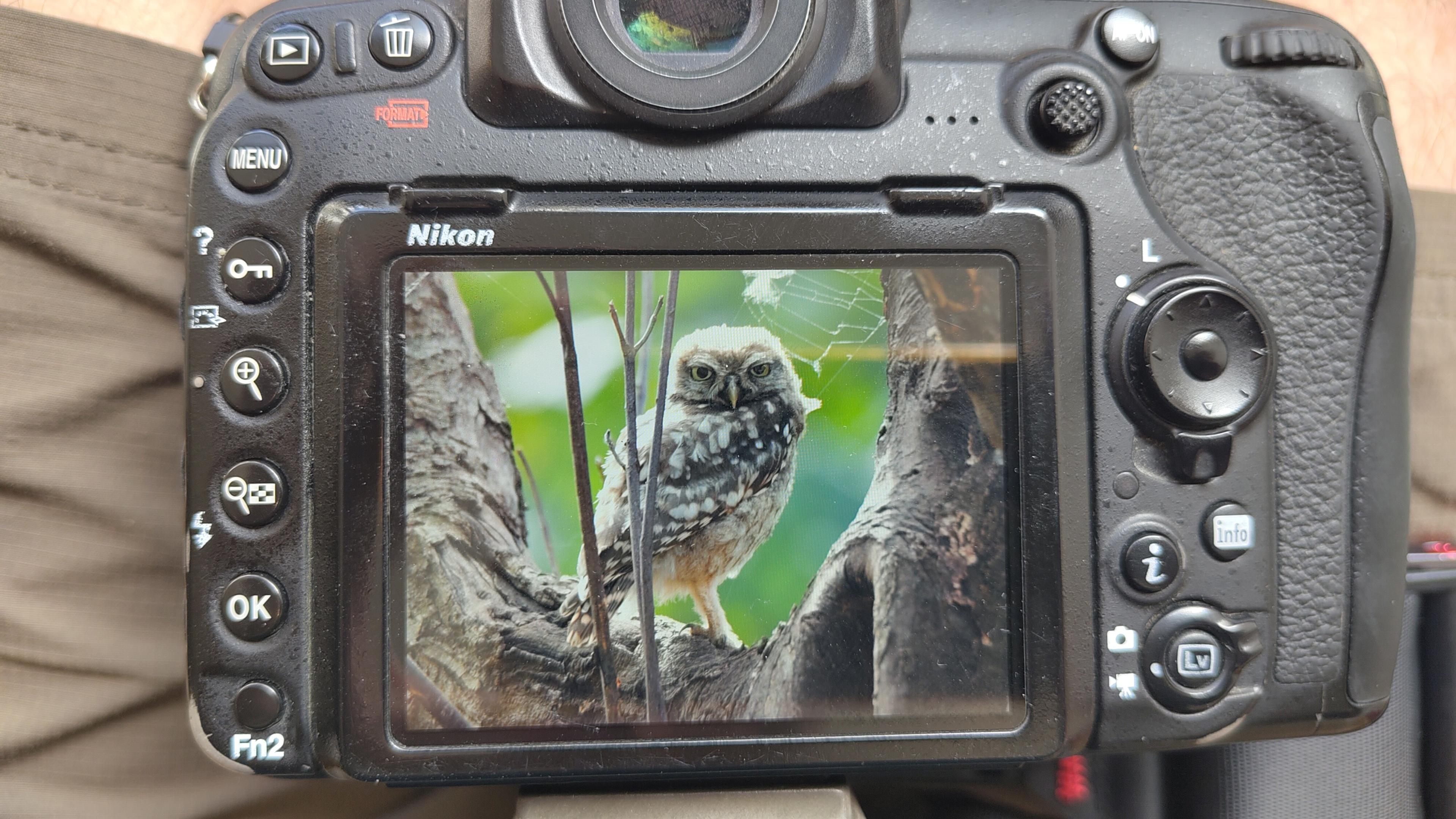
I went to a park (Bushy Park) to look for some owls.
I found Owls (Little and Tawny), but also a Green Woodpecker and two Kingfishers.
Snaps from my camera screen, and real photos will follow, but not of the Kingfishers as they were too far away and the photos are blurry.
#london #BirdPhotogaphy #BirdsOfMastodon #Birds #photography #BirdsOfFediverse #BushyPark
I hiked 13.8km in 4h44m12s
Created a chocolate shop and a restaurant; Updated 6 restaurants and an address; Confirmed 5 restaurants, a community_centre, and 3 other objects
Created a restaurant, a fast_food, and 2 other objects; Deleted a restaurant
I walked 8.5km in 1h31m45s
Created 2 buildings and a hairdresser shop; Updated a restaurant and an estate_agent office; Confirmed a cafe
I walked 2.2km in 38m09s
Merged pull request #1096
Bump actions/checkout from 6 to 7
Merged pull request #1095
Improve Tiverton Green mapping
Created 2 gates
I walked 7.1km in 1h23m15s
I walked 1.0km in 9m24s
Realign streets. They now have much less wide corners into each other.
Updated a fast_food
I walked 9.1km in 1h35m41s
I hiked 4.7km in 3h24m10s
I walked 6.7km in 1h12m03s
I walked 7.7km in 1h47m24s
Updated a pub
Updated a pub
Created a bar; Updated a bar; Confirmed a restaurant and a bar

Shortlink
This article has a short URL available: https://drck.me/bus-wem-hs2