
Contributing Advent 14: Brown Hart Gardens
Besides fixing bugs from ITO World or OpenStreetMap notes I also tend to do some general mapping when I am out and about. Coinciding with my "buying the whisky of the month" event (if you want to contribute to this, see the wishlist ;-) ), we ended up walking past a rather curious building with a park on top in London: Brown Hart Gardens.
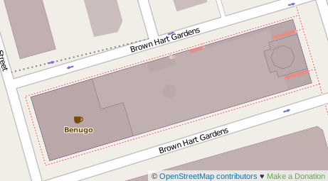
The gardens, new café, and the "Duke Street Electricity Substation" that lays underneath were not mapped at all, and of course I could not let that be. From photos and memory, I re-created the gardens in JOSM, my preferred OpenStreetMap editor and now it is available on the map — including the steps and the elevator:
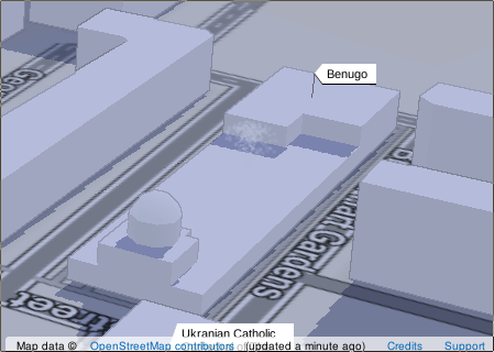
There is also a 3D rendering available:


Life Line
Updated a cafe
Specify street/place names to addresses
Specify bicycle parking capacities
Specify bicycle parking fees
Specify bicycle parking access
Specify whether crosswalks have tactile paving
Specify width of opening
Specify whether pitches are lit
Specify pitch surfaces
Specify whether pedestrian crossings have markings
Specify step counts
Survey tactile paving on steps
Specify whether steps have a ramp
Specify which way leads up for steps
Specify whether pedestrian crossings have islands
Specify whether pedestrian crossings have traffic signals
Determine roads lane count
Specify whether roads have lane markings
Survey if places still exist
Specify whether roads have sidewalks
Survey postbox collection times
Survey opening hours
Determine whether ATM allows depositing cash
Specify bicycle parkings covers
Shortlink
This article has a short URL available: https://drck.me/adv1314-af6