
Contributing Advent 12: Geospatial algorithms
This is technically not a new contribution, but one I've been working on and off at for the past months. The geospatial PHP extension contains a whole bunch of algorithms that deal with geospatial problems. The Haversine and Vincenty functions calculate distances on a globe, an implementation of the Helmert transformation algorithm converts between different datums, and some general functions to convert from f.e. 16°45'12" N to 16.7533° N.
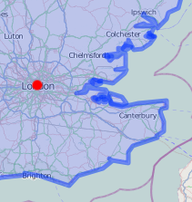
These are all useful functions, but I'd like to talk about an algorithm that I've added some time ago now. It is an implementation of Ramer-Douglas-Peucker that can be used to simplify a polyline. I have used that for the display of the timezone boundaries that I show in one of my maps examples: http://maps.derickrethans.nl/?l=timezone&lat=51.5&lon=0&zoom=8. The boundary data that I have for the UK for example, is so complex that it takes quite a bit of time to render them on the map. On higher zoom levels where that amount of detail simply does not show up, we can of course do with a simpler line, and that is what RDP helps us to achieve.
The algorithm has as input an array of coordinate pairs:
$points = [
        [  0,  10 ],
        [  1,   6 ],
        [  3,   0 ],
        [  5,   6 ],
        [  7,   8 ],
        [  8,   7 ],
        [  9,   4 ],
        [  13, 10 ],
];
As well as a parameter (called ε) that determines the maximum distance from a line that a point is allowed to be so that it is included in the returned array. The algorithm is recursive and will for each segment—starting with the whole array:
-
Find the further point from the line as marked by the first and last point
-
If the point is closer than ε to the line segment then any points not currently marked to keep can be discarded without the simplified curve being worse than ε.
-
If the point furthest from the line segment is greater than ε from the approximation then that point must be kept. The algorithm recursively calls itself with the first point and the worst point and then with the worst point and the last point (which includes marking the worst point being marked as kept).
With the above $points array, we can run the function like:
$points = rdp_simplify( $points, 2.75 );
We are left with:
$points = [
        [  0,  10 ],
        [  3,   0 ],
        [  5,   6 ],
        [  9,   4 ],
        [  13, 10 ],
];
The image below shows the effect of ε = 2.75 and other values:

In case you do not want to install a PHP extension to get that functionality, I also have an example implementation in PHP at https://github.com/derickr/3angle/blob/master/rdp.php, however, the time it takes to run the algorithm in PHP is about the same as the browser needs to draw the additional points of the lines.
Expect to see an updated version in the geospatial extension that also handles multi-polygons in the future. This should speed up running this over the large amount of UK polygons, as there are plenty of islands that also need to be done.


Life Line
Created a bar; Updated a restaurant and a pub
Updated a bar
Updated a restaurant
Updated a bar
Updated a bar; Confirmed a lawyer office, a cafe, and an ice_cream
Updated a restaurant; Confirmed a bar and a restaurant
Updated a pub
Updated a restaurant
Updated a vacant business
Updated 2 bars, a deli shop, and a pub
Confirmed a supermarket shop
Updated a bar
Updated a bar
Updated a pub
Updated a bar
I've just finished reading "Schoofhondjes" (lapdogs, in Dutch).
The "Schoof" refers to the previous Dutch prime minister Dick Schoof, being the lapdog of Geert Wilders.
A great collection of columns, although I did need to Google some of the names and references as I hadn't heard about all of them!

Updated a bar; Confirmed a restaurant
Updated 3 restaurants, a vacant shop, and a bar; Confirmed a cosmetics shop, a cafe, and 2 other objects
Created 2 benches and 2 waste_baskets
Deleted a cycle_barrier
Put Kilburn Park station node in a more representable location (not at the back of the building where you can't get in)
Merge branch 'v2022'
Go with 2022.17
Merge branch 'v2022'

Shortlink
This article has a short URL available: https://drck.me/adv1312-af4