
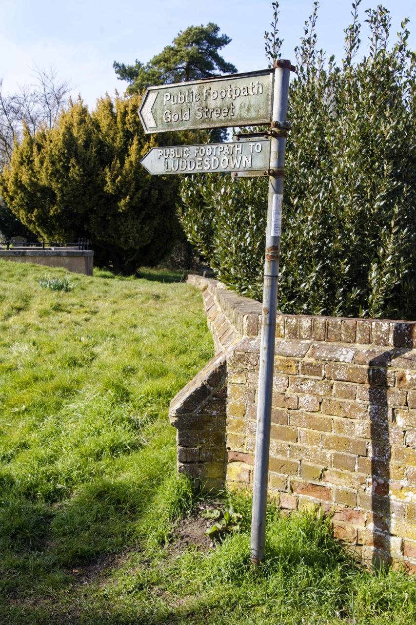
The Ridgeway
I have walked some of the UK's local and national trails in the past, first the London LOOP and Capital Ring, then the Thames Path and North Downs.
I had meant to walk the South Downs since 2020, but then the world changed, and I walked the length of the tube network instead.
But it is now 2023, and it is time to tick off one more of the national trails. I originally wanted to walk the South Downs, following the North Downs, and the Downs Link. But it turns out that The Ridgeway is celebrating its fiftieth anniversary, which would be more fitting for this year. The South Downs will be there next year too.
Like with the Thames Path between the source and Oxford, public transport between the stages can be complicated. I started planning the first two stages sometime in July and opted to do the first two 32 km sections on a Thursday and Friday in early September, as the temperature would be sensible.
Day 1: Avebury to Bishopstone
I booked my hotel, Helen Browning's The Royal Oak in Bishopstone, on the Monday before my walk, so I was pretty sure it would not rain much these first two days.
On Thursday, September 7th, I took an early train from Paddington to Swindon. Even my advance ticket was expensive, at £59. I left plenty of time, about 27 minutes, to catch the hourly bus to Avebury.

Not unusually when relying on UK railways, this plan failed as soon as I got to Paddington. My train left a little under 20 minutes late, meaning I would have less than 10 minutes to get to the bus station. When I got to Swindon, those 10 minutes had dropped to 4. I had to sprint to the bus station and managed to catch the bus as it was about to leave, already drenched.
The bus to Avebury takes about half an hour, and I ended up chatting to a fellow Ridgewalker. He had already done most of it, but not linearly.
Avebury is a fascinating place. The village is surrounded by a stone circle. Not as impressive as Stonehenge, but certainly more extensive.
I spent some time exploring before setting off to the start of the Ridgeway on Overton Hill. On the way there I walked through the majestic West Kennet Avenue and The Sanctuary, looking out over the valley to Avebury.

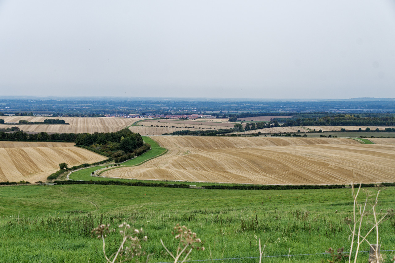
The walk started for real on Overton Hill. I was already sweaty because I had to walk up this hill. Instead of a lovely cool autumn morning, it was already pushing 30°C with high humidity.
From the start, the route gently ascends on easy-going paths. You can cycle or ride a horse for most of the Ridgeway, and the trails are usually reasonably wide.

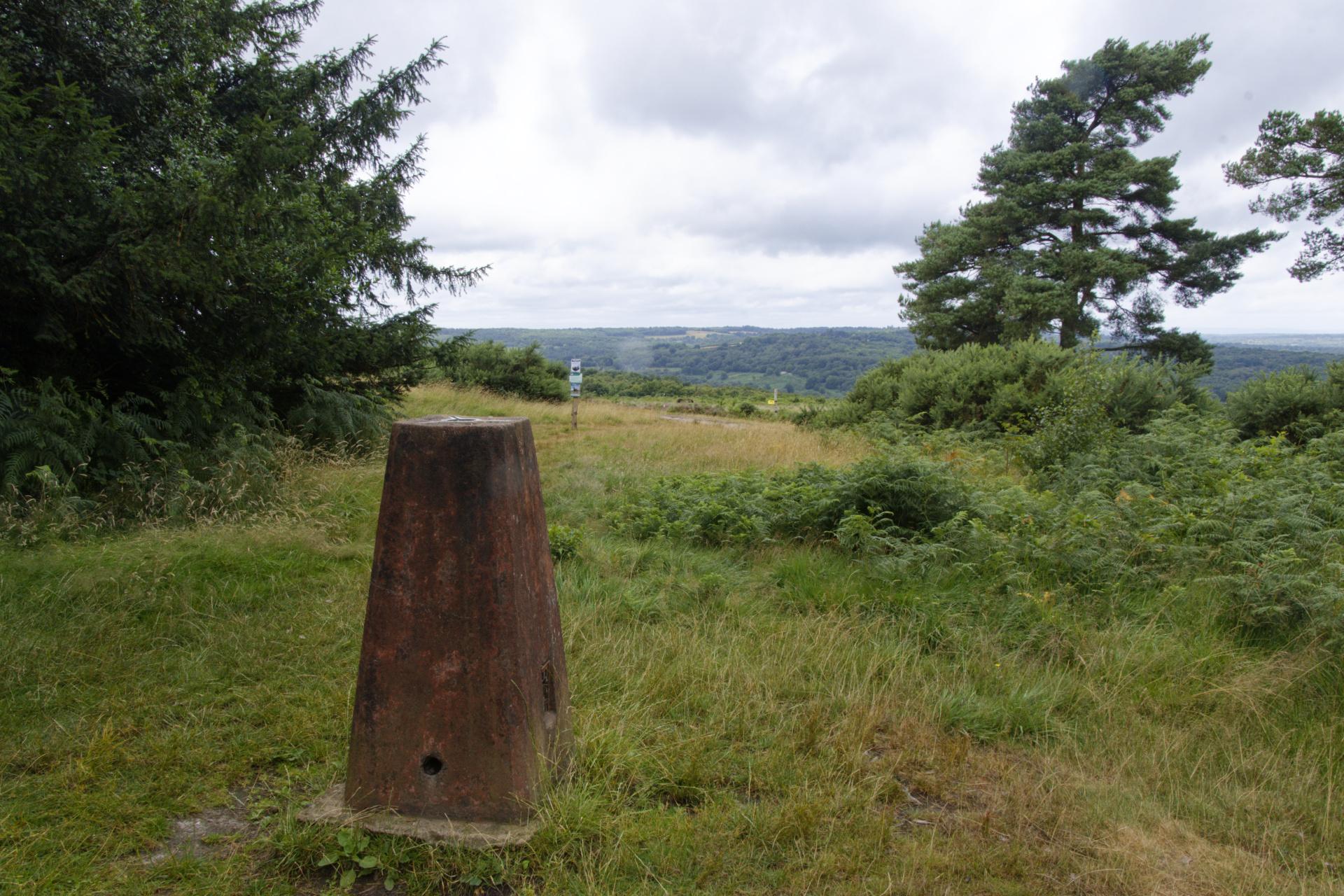
At the top of the first gentle incline, I ended up at Hackpen Hill. This hill has a white horse in chalk on the side. I wanted to visit a few archaeological sites while walking the route. This was an early opportunity.
The path towards the chalk white horse was blocked by an actual white horse. Therefore, I set off along the S-bend road instead. A large concrete mixer approached me, belching out black smoke, or so I thought. I took a deep breath and closed my nose until I realised it wasn't smoke but a nice, cooling, fine water spray!
Once I reached the bottom, I walked along the footpath back up the hill, only to find that I couldn't see much of the chalk horse. It's a bummer for such a steep climb. And then, the horses blocked access to the gate to get out of the field again! This time, I gently squeezed past them.
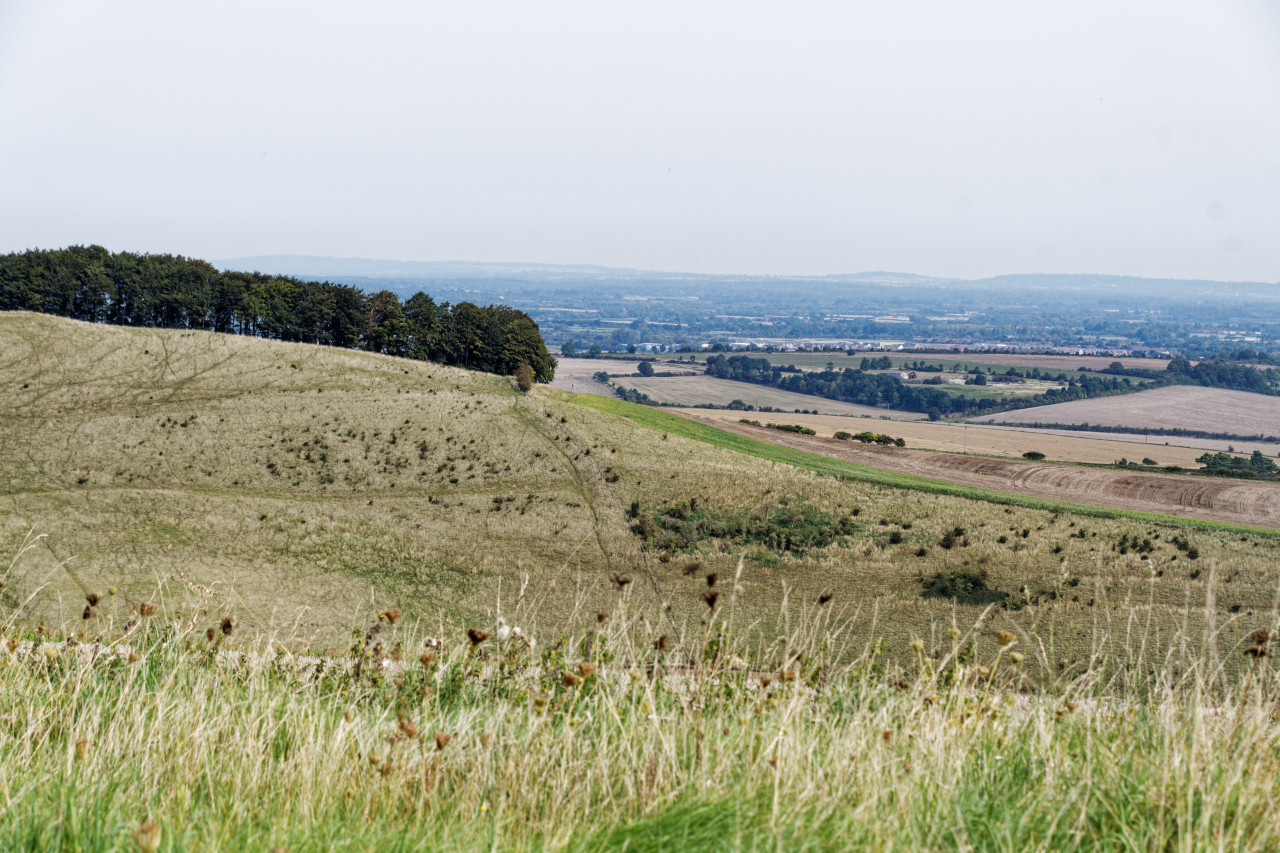
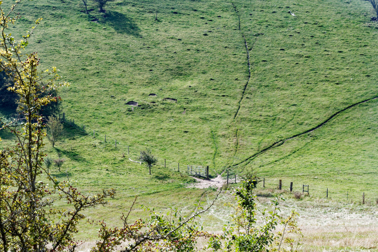
Once recovered from the steep way up the hill, I continued and soon came upon Barbury Castle, The route went straight through the middle of it, but as there was little to see beyond the round embankment, I continued without stopping.
The view opened up after going through a wood, and a path was visible for a long way down into a valley. I chatted with a few fellow Ridgeway walkers, and they were surprised that I was going all the way to Bishopstone. They were doing the more traditional set of sections and finishing not far away in Ogbourne St George.

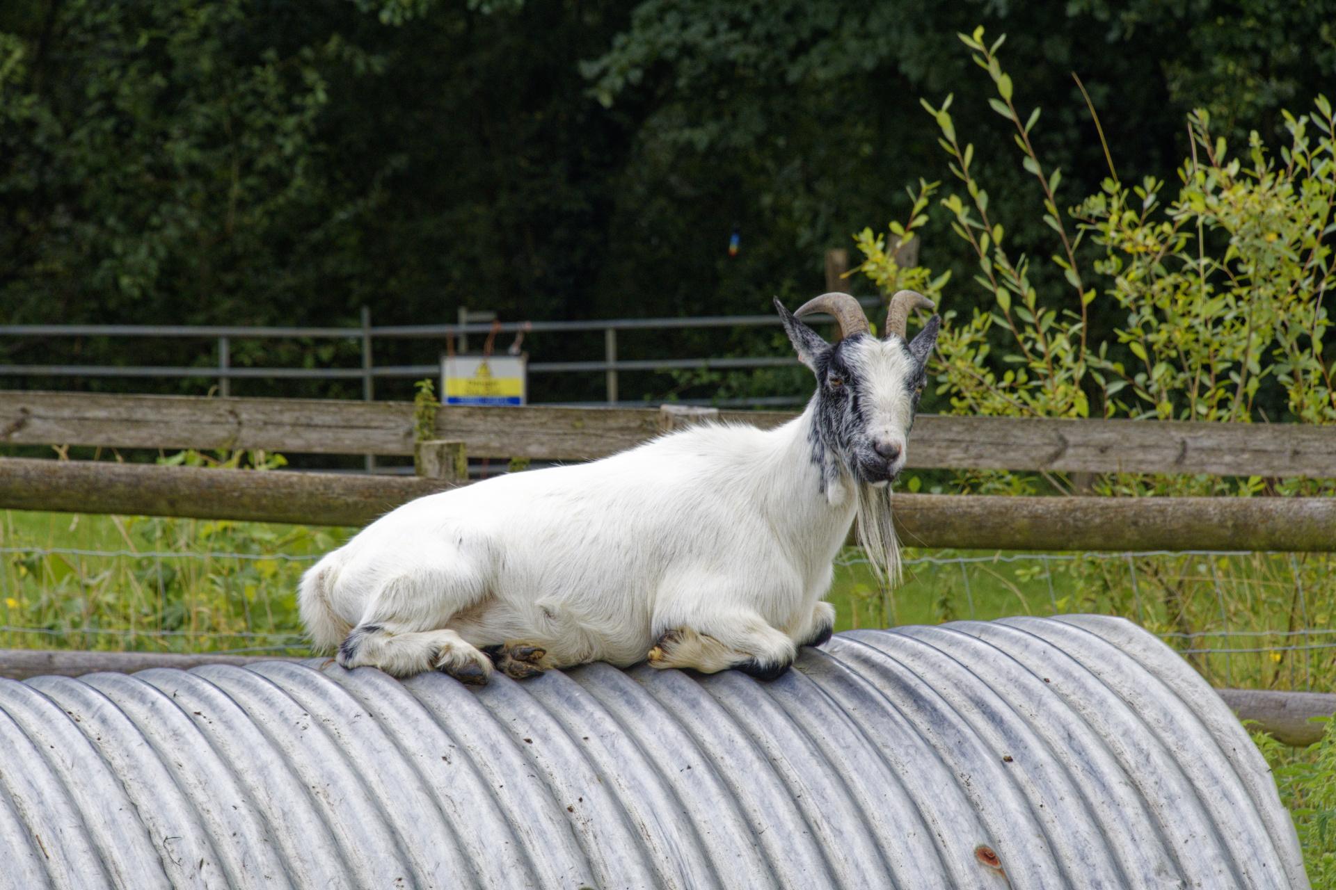
The path was fairly undulating for a while, and once I got down to the bottom, it was blocked by a herd of cows. I had to go slightly up the hill to get around them. Luckily, they did not seem to even acknowledge my presence.
As it was a hot day, I was quite pleased to find a stretch covered by trees on my way south of Ogbourne St George to cross the A346. This road lies in a valley, meaning you need to descend into it and climb back up to the Ridgeway on the other side. However, you get a good view of the village.

The route also turned north, alleviating the strong sunshine on the right side of my face. Near Lower Upham, I rested on a bench under the trees. My energy levels were really low, and I had little water left. In hindsight, I did not have enough for a long walk in this warm weather. Even my energy bars had all melted together and were hard to eat. But as I had no other option, I set off after about half an hour.
The views from this section were excellent, though, with rolling hills, villages, and cities in the background. A fair number of tractors were also out on the fields.

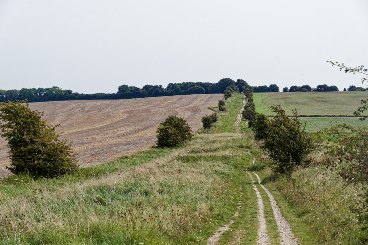
After bypassing another hill fort at Liddington Hill, the route brought me out out on a fast-moving road with the same name.

Here, a road section of the Ridgeway starts. It is along a road with no pavement and only a tiny verge. This was rather unpleasant, and I wonder why not some arrangements can be made for walkers. The sign with "Ridgeway National Trail" alone wasn't cutting it.
I could see Charlbury Hill from here, though, which I knew was near the finish of today's walk. Unfortunately, it meant I had another 60 metres of climbing to do, luckily no longer along a road with traffic.
It was now getting slightly darker, and after a short while, I finally could head down to Bishopstone for a shower, meal, and sleep. That last stretch down from the Ridgeway was enjoyable and almost like going through a canyon.

I arrived at Helen Browning's Royal Oak a little after five. The small complex includes a pub, a farm shop, and a hotel.
I entered through the first, picked up my keys in the second, and then headed to my room. The first thing I did when getting to my room was to drink at least 2 litres of water before enjoying a lovely cold shower.
I relaxed a bit and then headed to the pub for a well-deserved lager, which I enjoyed in the lovely beer garden. I had a table for dinner booked for seven but ended up ordering a little earlier because I was ravenous. Unfortunately, my order had gone slightly wrong (they lost it), and dinner only showed up around eight. Their venison burger was amazing, though, and so was the complimentary salad I received because of the food order mess up.
After dinner, I went to the hotel's communal area, where I relaxed a little and read. Not soon after, I went to have a nice long sleep in a bed.
Day 2: Bishopstone to Chilton
After a restless but relatively long sleep, I rose early to enjoy breakfast at the hotel — their home-made apple juice was delicious. I wanted to beat the warmest part of the day, and therefore, I wanted to leave as early as possible.
I left just before nine and explored the village a bit — mostly because I got lost! After finding the little path between two cottages, I headed to the Ridgeway. This second day's walk would be slightly less hilly, but the forecast still called for temperatures around 30°C and a few more high clouds. I had created a "Plan B" in case it would be too rough again: I would stop the walk earlier at Wantage.
Although today's whole route was a little hilly, the first thing I had to do in the morning was to get back onto the Ridgeway, which involved a fairly long climb. Again, I was sweating before I even started the walk.

But the Sun wasn't beating this hard today, and the walk started by going over the nice wide paths. There was also some more shade from trees and brambles. I enjoyed quite a few juicy blackberries in the places where they looked good enough.

After about 2 km, I came upon a farm, and the farmer had kindly provided a water tap. This meant I could empty one of my water bottles and instantly fill it. This was welcome and alleviated my concern that water would be a problem again today.
Not far after that, I spotted a sign to the Rose & Crown: "Down the Hill". Having recently climbed up to the Ridgeway and been going for around an hour, I decided that this was not a good offer and continued along the top.
A little further along, I stumbled upon Wayland's Smithy long barrow, used for burials over 5,500 years ago. I looked around before continuing my walk. I was glad for more tree cover and those light, hazy clouds that tempered the Sun's impact.

The next point of interest was the ancient hill fort at White Horse Hill. It has another chalk white horse on the site, but this time, I decided not to walk down the hill to see if I could see it. Aerial imagery will have to do.
I did walk around the hill fort in the same location for a while, and there were some great views of the surrounding countryside.

Near the top of the next hill, I spotted a bunch of butterflies. They weren't straightforward to photograph as they kept flying away!

I was lucky with this lovely Red Admiral, which sat still long enough.
Amazingly, there was another water point not far away. I repeated my routine of checking whether it was working, drinking all the water I was carrying, and refilling my bottles. But this time, I had around a third of this day's 20 miles left. On I went.
The walk was going much easier than the day before, helped by the clouds, and having enough water. Although the sky was a little hazy, the views were still great. I had a lovely time walking and decided not to cut the walk short at Wantage.
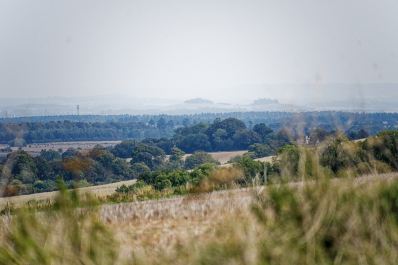
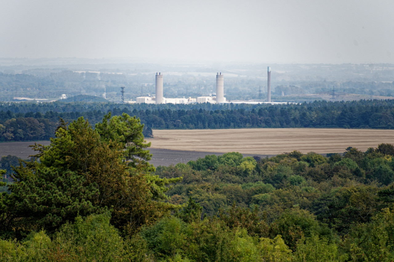
From the Ridgeway, I could see the Wittenham Clumps, Didcot Power Station, and, nearing the end, the Harwell Campus with the Diamond Light Source, the UK's synchrotron.
After crossing underneath the A34 through a dodgy tunnel, I had finished my stretch along the Ridgeway, and it was time to head down the hills towards Chilton, where I was hoping to catch the once-an-hour bus to Didcot.
Of course, I ended up missing it by a few minutes. Instead of standing around, I walked to the next possible bus stop, which was about a 15-minute walk away. A bus comes every half hour- but not at this time of day, apparently.
So I set off once more to a stop, which I knew had a service every 15 minutes. I knew it was the location of the Diamond Light Source, but I had yet to notice that this was right in the middle of the UK's atomic energy and space flight campus.
The bus to Didcot was uneventful, and once I got to the train station, I bought a big bottle of water. I was still thirsty, even with my extra supply of on-route water. By this time, the light clouds had disappeared.
I was lucky with the trains, as one to Paddington arrived just as I got to the platform.
Day 3: Chilton to Wallingford
A week later, I was again on my way to Chilton by train and bus to walk the third section to Wallingford. The temperature was in the mid-20s, and it was a bright day.
The bus route also gave me a tour of the whole Harwell Campus, with all the space and atomic energy research places. And big "Keep Out" signs.
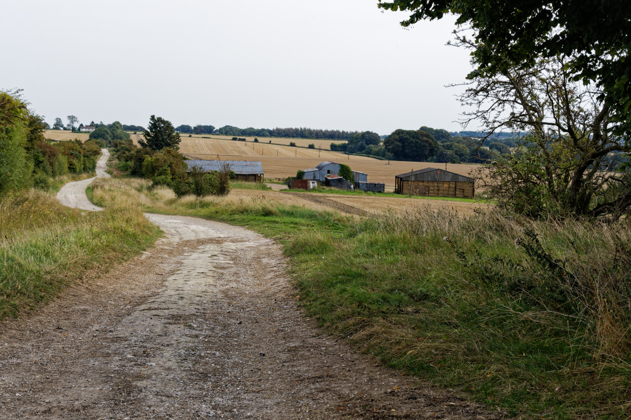
Once I got to Chilton, it was time to start walking. As I had come down from the Ridgeway last time, I had to climb back up again.

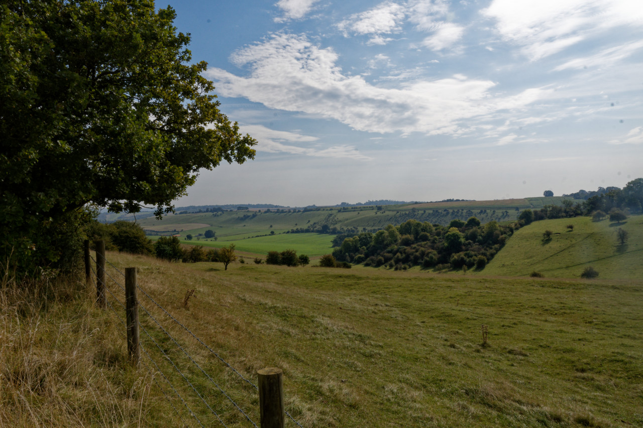
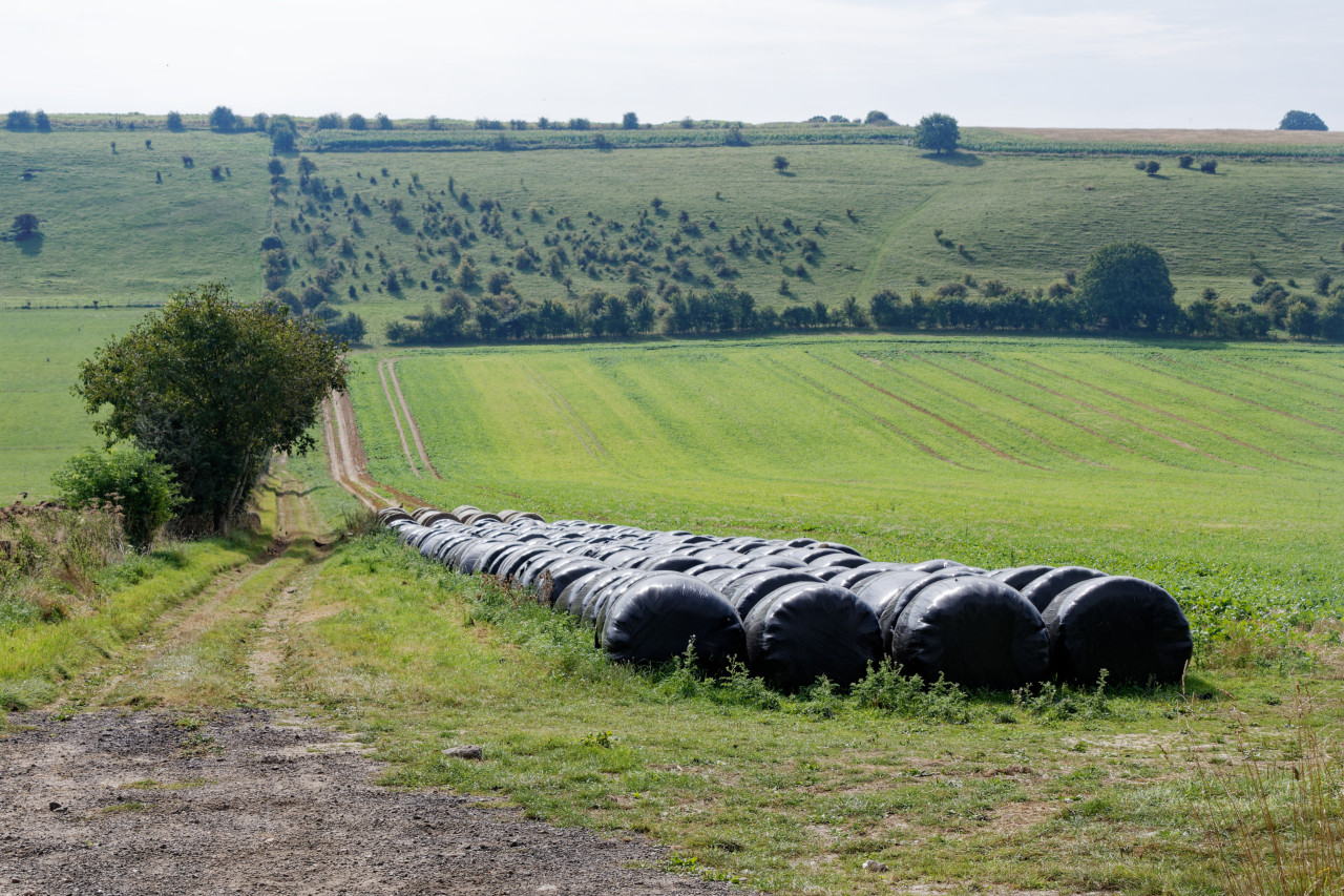
The first 2½ km was primarily flat, over nice wide paths. On each side were galloping courses for horses, with a few riders out on this lovely morning. Then, the route turned due east towards Goring. This section was quite up-and-downy, with beautiful views peeking through the hedges. A few red kites were out and about.
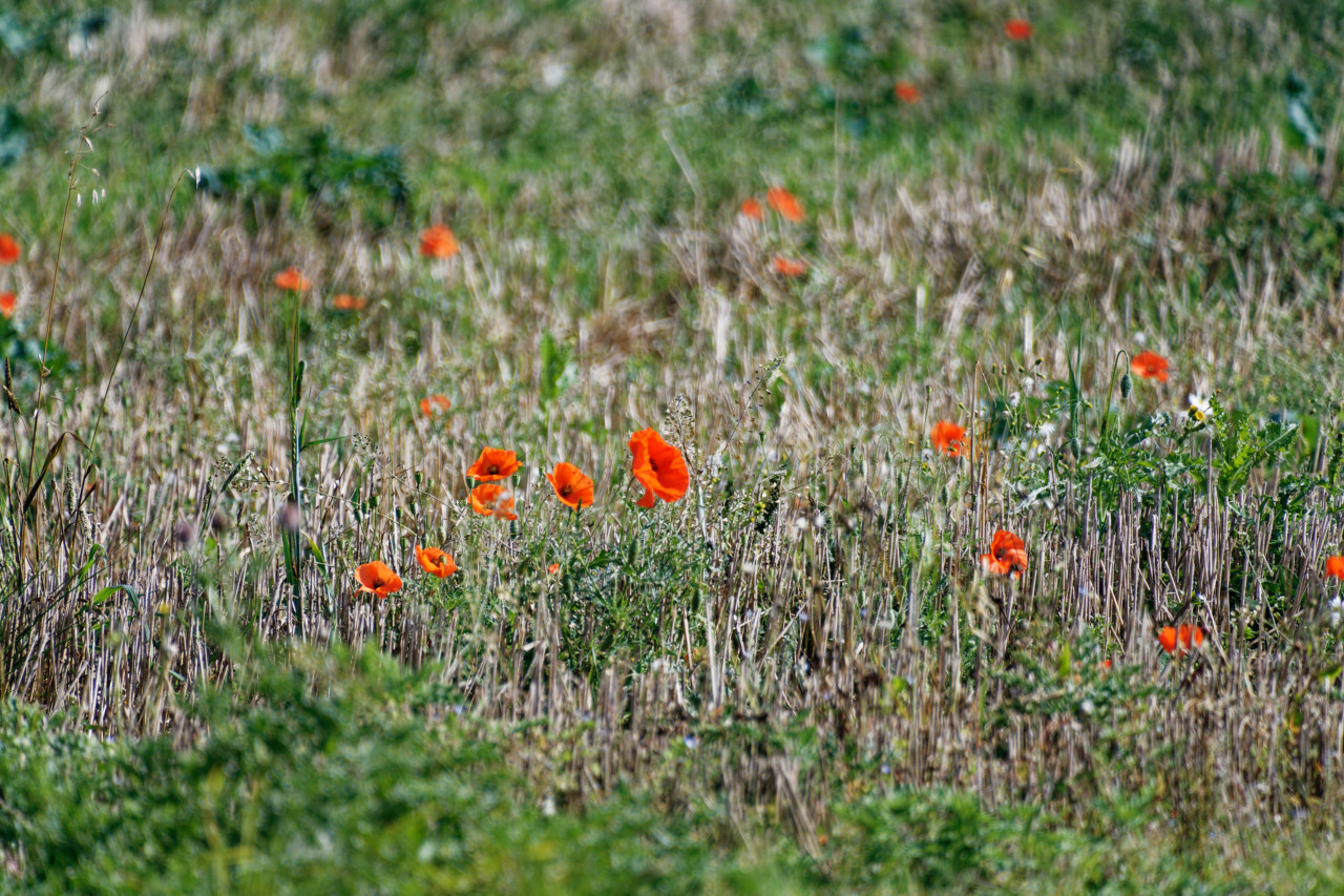
I enjoyed the views, including a field with many poppies.
After a section through a lane of very green trees, I ended up on a road with a mansion, a golf course, and finally, the outskirts of Streatley. The closer to the village, the more traffic there was. At some point, a very narrow pavement appeared before getting to the High Street with a lovely row of brick buildings.

After crossing Goring Bridge, the route heads north along the Thames. I previously walked the Thames Path, but its route is on the other side of the river. I understand why, as you can get closer and see the river.

After a wall with butterflies, where I spotted this lovely Red Admiral, the walk was mainly behind riverside properties. From South Stoke, the route finally gets close to the river for a little while. This section of the walk is flat because it is next to the Thames. The paths are often well-trodden grass, making for a relatively easy hike.
The route into North Stoke was mainly on the east side of the treeline bordering the Thames, which provided lovely open views of the surrounding hills.
At North Stoke, the route passed through a churchyard along a lovely row of bright pink-flowered houses.

North of the village, the Ridgeway crosses a golf course. Luckily, you can't see much of it as the route is lined with trees and bushes. Just south of the A4130, the walk's route goes east, but for me, this was the end of this section.
I walked into Wallingford along the Thames Path and was again lucky to catch the bus into Reading, which was ready to go.
This was really a section of two halves. The first half is hilly, with great views and the occasional horse. The second half is along the Thames, which, sadly, I rarely saw. It being flat made for a nice change, though.
Day 4: Wallingford to Lewknor
I took the "River Rapids" bus to Wallingford from Reading. At £2, it is still a bargain. I hope this scheme will be extended and/or made permanent.
I decided to walk on the other side of the Thames — the side not on the Thames Path — to get back to the Ridgeway for some variety. The paths were grassy and, if not for a herd of cows, also pretty quick.
After crossing underneath the A4130, I got stuck behind a group of teenagers. Looking at their gear and maps, they were probably on a Duke of Edinburgh's Award walk. I got confused and walked in the wrong direction to get ahead, meaning I now had to follow them for half a mile on a narrow path through the woods.

I managed to get ahead of them again after a moderately dangerous crossing of the B4009, where the path continued going through the woods on a steady but slight incline.
The path was windy and narrow, and the Sun was straight ahead. It was a lovely morning, and I was enjoying myself immensely.

The path through the woods lasted about five kilometres, crossing a few farm roads. Eventually, the route followed South Oxfordshire's Grim's Ditch, right next to the path to the north.
A little before Nuffield, at Grimsdyke Cottage, I found another water point. The day was not nearly as hot as the first two days of my walk, but the water was undoubtedly still very welcome.
After another 5 minutes, the path reached one of its higher points and turned northward. There were good views over the Thames Valley, although part of it was occupied by the Huntercombe Golf Club at Nuffield. The path was strictly set out with a series of "numbered white painted bollards", but the promised numbers were missing.
At the top, I had to cross the nearly empty A road towards Nettlebed, home of the famous Cheese Shed. It was tempting but would have been an hour's detour. And to get to cheese, that is even too far for me.
The route continued down a path through a freshly harvested field before becoming steep on the way to Ewelme Park. The view towards where I came from was fantastic.

The route became slightly undulating here, with woodland sections, before coming up at the church at Swyncombe, where a bunch of crows were flocking about on Rectory Hill. After having reached the top, the Ridgeway continued along a field of sheep at the bottom near a stream. There was also a good view of the hill that I had to walk up next to the side of Swyncombe Downs. The woods were fresh and green, protecting me from the bright Sun for a while.

After coming around the bottom of a field, a manor house, North Farm, on the next hill came into view through the trees. The path was lined with bushes with many red berries.
Near the farm, the route changes direction again and heads straight for Lewknor and the village of Watlington in the valley below. The path widens, similar to the section between Chilton and Goring. It is partly exposed but also passes through the woods.

After about a mile, I encountered a few walkers with race numbers. The stream of them became denser and denser, and my lovely, relaxed walk became more arduous. I had to step out of the way and dart from left to right on the path. At first, I greeted them, which was alright.
I became quickly fed up, though, as the people coming towards me only had to say hello once, or step out of the way once, to be able to pass. I had to do that several hundred times. It was a real chore, making the rest of my walk significantly less fun — I get out of the city to not encounter crowds!
After a while, I could see my finish point for the day becoming larger and larger, with the occasional sound of the M40. There were many sheep in front of the Aston Rowant Nature Reserve's hill.

I crossed under the M40, and shortly after that, I left the Ridgeway and headed to a new form of transport, the Oxford Tube, a coach service between Oxford and London. It had a convenient bus stop just off the M40 called the Lewknor Turn. Once I got to the stop, the coach arrived nearly instantaneously. It goes every 15-20 minutes, so it would not have been a problem if I missed it. For £20, you get a three-month open return. The coach was comfortable and speedy until the outskirts of London near Hillingdon. There was a lot of traffic, so I will try to catch it further from Victoria Coach station for the next and penultimate section.
Day 5: Lewknor to Wendover

Today's walk started with a bus ride to my coach stop. I had booked a return on the Oxford Tube, and as I was unwilling to sit in London traffic, I headed to Notting Hill Gate instead of Victoria to alleviate some of this.
The coach ride was uneventful, although it was a bit busier, even this early morning. With the days getting dark earlier, I thought setting off early was wise.
After arriving at Lewknor, I had to get up to Ridgeway level, which involved a steep climb along a narrow road lined with colourful trees, creating a tunnel effect. Once at the top, the low Sun blinded me as it reflected on the slightly wet road.
Once on the Ridgeway, it became clear that autumn had properly started. Large amounts of leaves were on the path, and the trees had burst into every colour.

This section of the Ridgeway was very much on a ridge, with occasional expansive views to both the left and right for a while. The path was easy-going.
Like the previous section, another race was going on on the route. This time, it was about half a hundred bicycles. It was a lot less annoying than five hundred walkers.
Just after Chinnor, my walk led me through the lovely Bledlow Great Wood before going southeast for a while with beautiful "scenes from the Windows Start-up Screen".

From here, my walk slowly trended downwards while continuing to produce great views of cows in distant but very green fields.
Soon, a steep climb up a hill produced sweat, and stunning 360° panoramic views at Lodge Hill.

On the other side of the summit, a herd of cows blocked my path. Instead of trying to squeeze past them, I decided to have a little detour to avoid them, as I did not fancy my chances with this lot.
Then, finally, the route left the high grounds of the Ridgeway and let me down the slopes towards Princess Risborough along some field boundaries and through a tree tunnel, keeping me away from yet another golf course.
After a level crossing, I had to scale another hill to cross the other single track of the Chiltern Main Line. A single poppy in a field led me along a quiet road to the much busier A4010, which I followed towards the town.

Although the road could have been more pleasant to walk along, the views of colourful trees and freshly ploughed fields to the right of me were more enticing.

Thankfully, the section along the road was short, and I soon found myself on a quiet gravel path. Annoyingly, it was on an incline, but that did not stop me from enjoying myself. Like me, a buzzard was following the edge of a field towards the foot of Brush Hill.
The hill is steep, but steps cover nearly half of the incline. I am usually not very keen on these, but here, it makes sense. The view from the top was worth the effort.

I rested here for a while, enjoying snacks and water, and watched red kites swooping and soaring through the sky.
After lunch, I continued walking. The route went down and then up again to another view over the valley at Whiteleaf Hill. While descending through the lovely "Hangings", the Sun lit up the first hints of autumn colours. Unlike earlier sections, the trees had yet to start losing their leaves here.

From here on, the route became familiar, as I had walked it a while ago on one of my SlowWays adventures, but in the opposite direction. First came the open hillsides of Grangelands and The Rifle Range, a peculiar name.
At the top of yet another hill, I spotted a bunch of mushrooms. I expected to see many more on my autumnal walk, but these were the only bunch.
After crossing a field, the Ridgeway skirts around outside the Chequers Estate, the Prime Minister's country party place. Menacing signs are warning you to keep out. At the moment, there isn't a fence on the section down the hill towards their driveway, which you'll end up crossing.


When leaving the estate, I headed the wrong way first and walked past a farm shop. I was tempted to get lunch there, but the queue was too long. I decided to continue walking instead. A dog refused to move, as it had not been bought a sausage!
The short climb into Linton's Wood revealed a path through the leaves cut out by the rain, which reminded me of walking around in the forest where I grew up. I enjoyed some of the more exposed tree trunks, which had few leaves and were still remarkably green.
After crossing and following a quiet road, I ended up on the slopes of Coombe Hill. The clouds were getting sparser, which created interesting patterns on the fields in the valley below.

A tall pillar memorializing the Second Boer War sits at the summit of Coombe Hill. I spent some time with my longish lens taking pictures of a wind turbine and a fire on a hill across the valley.

Towards Wendover, you can clearly see the extensive works that are part of the building efforts of HS2, the new high-speed railway that now unfortunately does not go to more useful places.
After taking a little break and admiring the views, I proceeded towards the finish, down the hill through the Bacombe Hill Nature Reserve.

It took me some time as there were so many red kites about. Flying, and hunting, and attacking each other. Most of them were just too far away for good photos. Their aerial acrobatics were a sight to behold.
After a while, I finished the walk and headed to Wendover station. As I descended, I enjoyed the last views of the valley.
Just before the station, the footpath was narrow due to HS2 building works. A footbridge across the tracks straight into the station's west side was blocked, so I crossed the tracks and used the main entrance.
I took the train back to London from Wendover, concluding the fourth and penultimate leg of the Ridgeway.
Day 6: Wendover to Ivinghoe Beacon

Trains to Wendover go from London Marylebone only once an hour on Saturdays. I went for the 08:27, as I thought the one an hour later would make it trickier to finish the walk before it got (too) dark. It is a good thing that I did, as the 09:27 ended up being cancelled due to a lack of staff. Which isn't really acceptable for a once-an-hour service.
It was not the nicest of days, but I was keen on finishing the Ridgeway before daylight saving time kicked in, and there would be way less time in the afternoon for walking. I dislike the early darkness.
I arrived at Wendover, therefore, reasonably early. It was early enough to see the morning fog lifting out of the forests that surround the city.

The walk through town was short, and I soon found myself walking around a lake and a church, climbing up the hill along a wooded lane. The trees on the hill to the north all had splendid colours. Autumn is the best season for this, although the clouds hadn't yet risen.

Soon after that, I found myself climbing through a forest. The leaves had yet to quite colour as much, and it had an eerie feel. Especially with the ground slightly muddy and springy.
The path widened a little after a while before ending up with a lovely view and some steps down into a narrow and muddy gully, which I followed to the road and crossed into some fields.

Unfortunately, halfway across these fields, on the other side of a gate and fence, a herd of cows was on its way to block my path. As I mentioned, I am not a fan of national paths going through fields with cows. Therefore, I decided to backtrack and walk around the farm.
My diversion was pleasant, even though I had to wade through mud. Although fully overcast, the view into the valley with colourful trees was lovely.
Once I had completed my detour, I ended up on the official route and into Northhill Wood. The trees hadn't entirely changed their colours here yet, so it was fresh and green. The wide path was easy, too.
After a short section along quiet lanes, I ended up in Bishop's Wood, at the top end of Tring Park. It is a lovely wide boulevard, and at this time of the day, it was full of people walking their dogs. The Sun was playing with the colours of the trees.

There were some excellent views over the town, but soon, I left the park and moved onwards to cross the A41. The path was easy-going again, and a lovely herd of sheep was grazing to my right.

I am usually not keen on having my walk interrupted by a busy road, but the view from the high pedestrian bridge across the A41 was pretty good. Colourful trees flanked each side, with the finish of the Ridgeway in the distance.
However, before I would get to my final set of hills, I wandered along another straight path with a slight incline to cross the Grand Union Canal.
The section just beyond Tring's railway station was along a road with a very narrow pavement. Fortunately, the section was short, and I went uphill again through the woods — first on a slight incline, then up a long stretch of uneven steps.

Once at the top, the route continues north along the side of the ridge, with sporadic open views to the west. By this time, it had become slightly brighter, with few clouds. However, it was getting a little windier.
Some of the paths were a little narrow here and sometimes a little muddy. The views were improving, especially with the unevenly lit lands below.
A single tree marked the first peak of this final section at Pitstone Hill. A few walkers were out, as it was a nice day. From here, I could also see my finish point, Ivinghoe Beacon.

But I was not quite yet there. From Pitstone Hill, you dip through a little depression in the hillside before getting up to Paul's Knob. I did not take the opportunity to go up it, as it was not the Ridgeway's route. I did, however, on my return to Tring. As if I needed to do more hills...

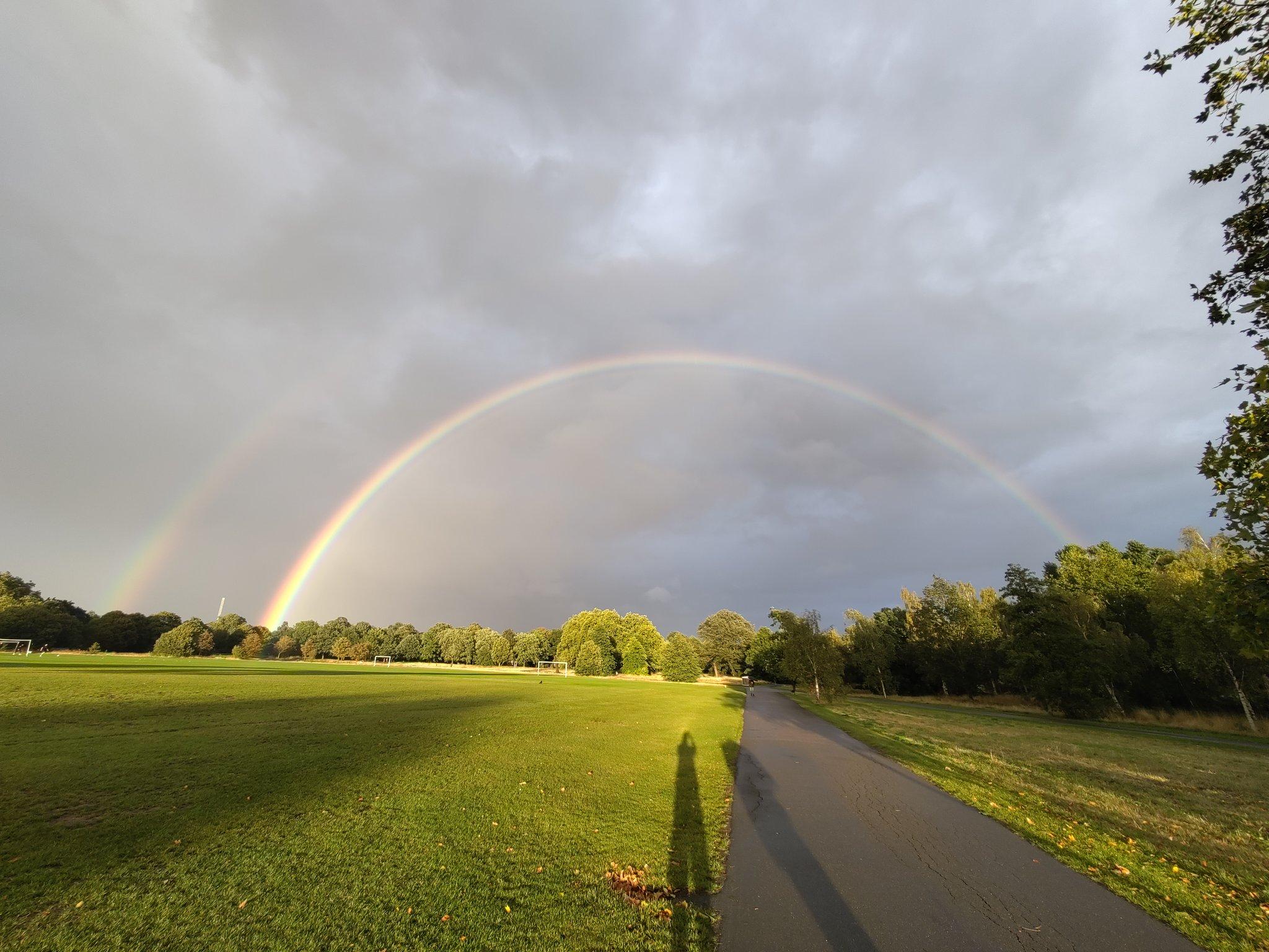
In this final section, it was getting a lot busier. A lot more so than at the start of the route at Overton Hill. I understand why, as the landscape is much nicer here, especially going up Steps Hill (without any steps). In the distance, I could now see a rain cloud coming, creating the "fingers of god" effect.
After coming down from Steps Hill a bit, there was one more push towards the finish. I didn't take the broader path with many people; instead, I followed the Ridgeway along its mapped route. I did not quite run, but I certainly put in some extra effort to race to the top and finish my adventure at the summit of Ivinghoe Beacon.

I spent a little time lounging around and enjoying a later lunch to relax and wait until people stopped blocking the things I wanted to take photos of.
There is a fair expanse of walking paths here, which makes for a lovely day out. However, I still had to get home, and after about half an hour, I set off. The rain clouds were now certainly nearer, too.
On my way back, I decided to get up all the little hills I had bypassed — I was here after all. After coming down from Paul's Knob, it started to rain a little. I thought the weather for my whole walk was pretty — albeit a little hot for the first two days.
Red kites were hunting again on the hillsides. I like watching these birds soar and occasionally dive to catch prey.

When I got to the station at Tring, I found that the ticket machine at the regular entrance was stuck in a mode that didn't accept key presses.
I was a little lost until I realised another ticket machine was at the parking lot side. Luckily, that one worked.
I had to wait a little for my train back to London. I used that time to get the mud out from under my shoes and reflect on the different sections of the Ridgeway — From the "ridge" walking in 30°C+ heat in the first two days, walking out of the hills, and along the river Thames on the third outing, the battle with 500 walkers going to opposite direction on my walk to Lewknor, my first encounter with autumn's colours while walking around the Chequers Estate, and finally this last section to the finish at Ivinghoe Beacon.
You can find more photos on in Flickr album "The Ridgeway".


Shortlink
This article has a short URL available: https://drck.me/ridgeway-i40