
Foursquare and OpenStreetMap
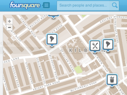
Yesterday, FourSquare announced that they are "joining the OpenStreetMap movement", meaning that the now use OpenStreetMap data for their map tiles. With their own map styles and using MapBox for rendering their styles. This is amazing news I think.
Of course, as with many changes, some people are happy but there are others that complain that the map data just isn't up to standards yet for their area. That's a fair point as OpenStreetMap does not have all roads and points-of-interest (POIs) of every city and town in the whole world. The geographical data has mostly been contributed by people on the ground with GPS devices through so called mapping parties. Both in places like London as well as in slums such as Kibera. For a look at the progress over such a weekend, check this video or have a look at "OpenStreetMap: A Year of Edits" for an animation showing all the edits in 2011.
Foursquare is all about spamming twitter, I mean, checking into venues to acquire points and badges. OpenStreetMap is all about having a database of geographical data, and that is not only roads! I've written on OpenStreetMap before.
A venue is a POI in the OpenStreetMap jargon. It makes a whole lot of sense to keep only one database of these POIs/venues. The venues are added (and fixed) by foursquare users in the first place so getting that data into OpenStreetMap would be awesome.
I think this is a great opportunity for fourquare to contribute the venue data to improve OpenStreetMap. I think in this case, there needs to be some form of review process before they can be added to OpenStreetMap, or perhaps consolidated with already existing POI data. This is going be an interesting challenge, and luckily foursquare already is toying with how to improve OpenStreetMap's data.
Besides venues, OpenStreetMap also contains roads and in places those roads are missing or don't have names. Perhaps foursquare can even sponsor mapping parties in the "empty" areas. In the end, a free-to-use open geographic database is what is beneficial to everybody.
For more information on OpenStreetMap, have a look at its wiki or drop by on IRC.


Life Line
Created 2 waste_baskets; Updated 2 bus_stops and 2 crossings
I hate this timeline.
For @fridaynightdinners I wanted to look up what the difference between Raviolo and Girasolo is.
DuckDuckGo's (non-ai variant) top three results are all AI generated content with AI generated author images, bio, and "flair".
I want stuff written by *humans*, not this AI slop BS.
Created 3 waste_baskets; Updated a waste_basket
Updated 6 crossings
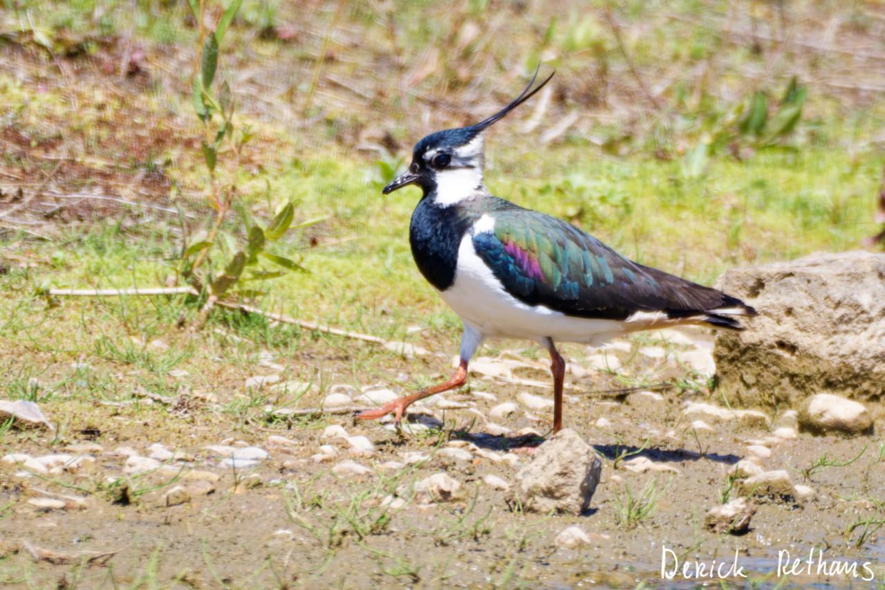
Northern Lapwing On The Move
This dapper bird is having a stroll looking for lunch. I like the iridescence in its wings.
#BirdPhotography #BirdsOfFediverse #Nature #Photography #London #BirdsOfMastodon
Created a vending_machine
Updated a bus_stop
I hiked 5.4km in 2h35m46s
I walked 2.2km in 27m13s
I walked 1.6km in 32m29s
I walked 3.3km in 34m33s
Updated a confectionery shop, a massage shop, and 2 other objects; Deleted a books shop
I hiked 7.0km in 4h21m00s
Updated a deli shop and a pet_grooming shop
I walked 4.2km in 49m42s
I walked 1.4km in 10m14s
I walked 2.2km in 1h43m13s
I walked 4.4km in 1h25m00s
Updated a cafe
Updated a bar
I walked 1.7km in 19m07s
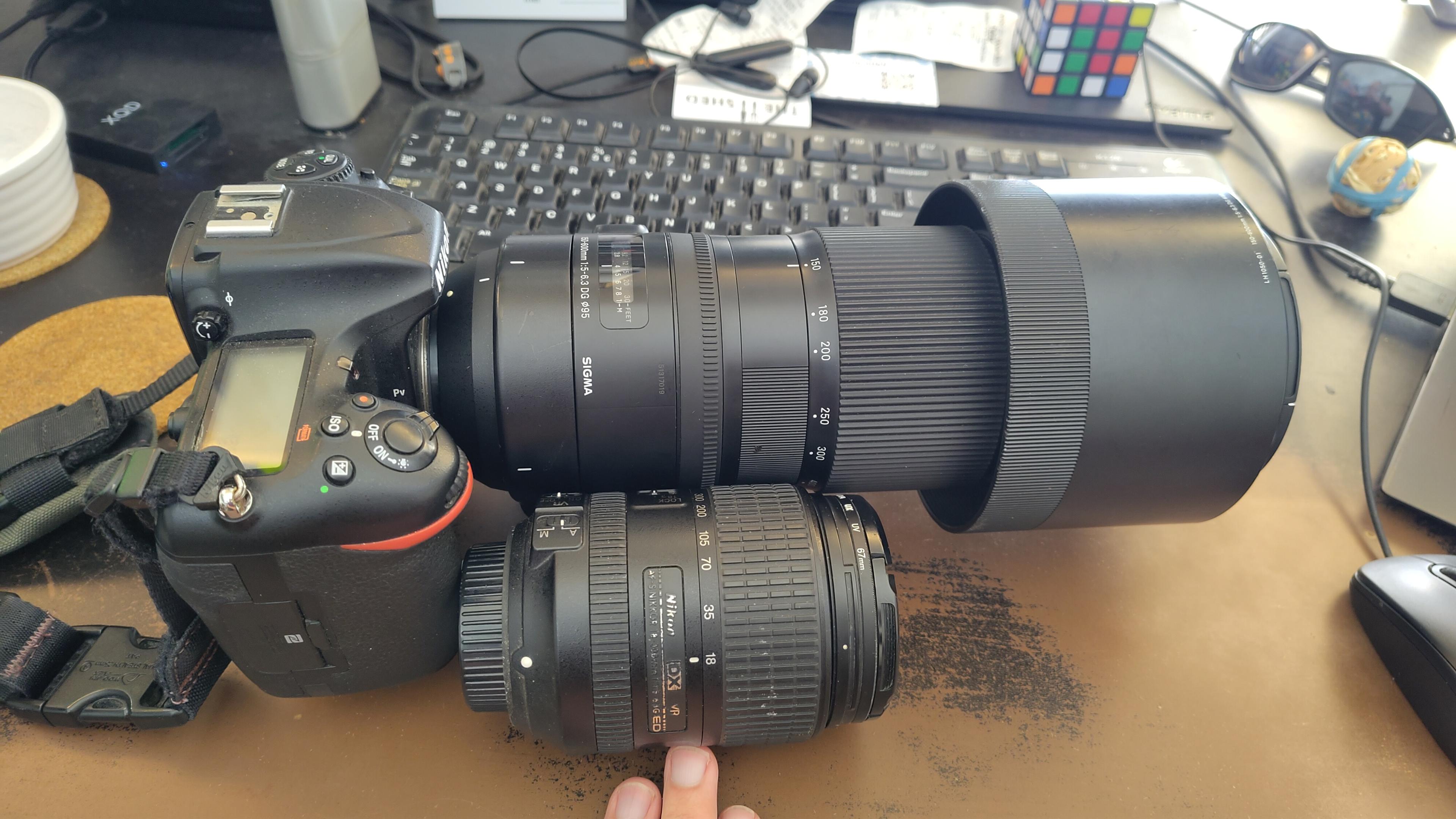
I got a new lens. It's a little bit larger, and loads heavier, than my older one.
#photography #naturephotography
I walked 1.6km in 15m10s
Shortlink
This article has a short URL available: https://drck.me/4sq-osm-9by